Isle of Gigha
| Isle of Gigha | |||
| Location Map ( geo) | |||
| |||
| From: | Port Mor (NR664545) | ||
| To: | South Pier (NR642463) | ||
| Distance: | 5.5 miles (8.9 km) | ||
| Highway Authorities | |||
| Traditional Counties | |||
The Isle of Gigha lies off the west coast of Kintyre in south Argyll to the north of Campbeltown. It is reached by ferry from Tayinloan on the A83. There are only two roads on the island, the main spine road which tends towards the eastern side of the island, and the spur down through the village of Ardminish to the pier.
Ardminish
All visitors to the island arrive at one of the two piers in Ardminish Bay. Those arriving on the Calmac ferry from Tayinloan arrive at the new pier to the north of the bay, whilst the few yachts and other boats that visit the island tend to arrive at the old pier to the south. The new pier was built to provide a better slipway for the car ferry, and also required a short piece of road around the bay to connect it to the rest of the island. The road down to the old pier has slowly been reclaimed by nature, and is now just a thin strip of tarmac past the island's pub, barely wide enough for cars.
From the point where the old and new roads meet, the road climbs steadily up into the village of Ardminish. The island's only piece of pavement runs along outside the island school on the left, and then at the junction on the right is the island shop / Post Office. This is The Junction, as in the only place where two pieces of highway meet on the island, but despite a wonky give way sign, there are no road markings!
Ardminish - South Pier
Heading south from The Junction, the road passes through the island's only village, Ardminish. Whilst most of the houses are less than 50 years old, there are a fair few older properties mixed in, including the island hotel on the left, now owned by the community. A couple of groups of newer houses on the right are served by roadways which are more like glorified drives than proper roads, and then as the houses peter out the road enters some patchy Woodland. That on the right is part of Achamore Gardens, which are open to the public and surround the old Lairds House. A rough track on the right leads up through the trees to the village hall and ruins of the medieval chapel.
Beyond the track, a number of drives turn off on either side leading, on the right, to Achamore House and Farm and the other to other farms at the southern end of the island. The trees come to an end, and the road runs through fields, climbing past a couple of bungalows and then dropping steadily as it turns eastwards to terminate at the head of the South Pier. This structure is used as the overnight berth for the Gigha Ferry, and while the building on it suggests that this was once the ferry terminal, there is no provision for unloading vehicles, so it seems it is perhaps an emergency pier for passengers only. On a clear day it is possible to see Ireland on the horizon from here.
Ardminish - Port Mor
Heading north from The Junction, the road passes the petrol pumps in front of the village shop, with the driveway to the island church opposite, and then heads out through open fields. Heading slightly east of due north, the road is very nearly dead straight for about a mile, albeit undulating. Driveways lead off to houses set well back from the road behind fields, and the fields on the left are home to the island golf course.
At Drumyeonmore Farm the road kinks northwards with a rough track heading east across the island past Mill Loch. The road then wiggles through a gap in the hills before dropping down past Tarbert Farm to the narrow neck, or Tarbert, of the island. This is a low lying piece of land, with stunning views westwards to Islay and Jura, and east to the mainland. There is a prominent standing stone on the right, and just beyond a pair of tumbledown cairns on the left of the road, which then climbs gently over a low hill towards Port Mor.
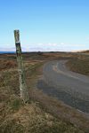
The last stretch of road drops steeply down through bracken to Port Mor, a small bay with the remains of a pier at the northern end of the island. The road once ran all the way to the pier, but now stops short at a grassy parking area, with just a rough track continuing. The views from here, as from most of the island, are great with Jura to the west and the Kilberry area of Knapdale to the north. The entrance to West Loch Tarbet is difficult to spot, unless you are lucky enough to see a ferry coming out / going in!
| Isle of Gigha | ||||
| ||||
|


