Isle of Rum
| Isle of Rum | |||
| Location Map ( geo) | |||
| |||
| From: | Kinloch (NM411990) | ||
| To: | Harris (NM334955) | ||
| Distance: | 10 miles (16.1 km) | ||
| Highway Authorities | |||
Scottish Natural Heritage | |||
| Traditional Counties | |||
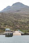
The Isle of Rum is the largest of the Small Isles lying between Mallaig and the Isle of Skye. It is largely owned by Scottish Natural Heritage, a conservation charity, but the local community have an increasing role through the Isle of Rum Community Trust. There are few roads on the island, despite its size, and all are surfaced in loose material, if at all. Naturally, none are adopted by the council.
Route
The road starts at the new ferry pier at Kinloch, where the Mallaig Ferries service calls most days. Cars can only be brought to the island with a permit from SNH, but walkers and cyclists are more than welcome. The road heads west staying fairly close to the shore of Loch Scresort and runs past the small island school before reaching a fork. The lower, right hand road is signed as the pedestrian route, while the left hand fork is the vehicular road, bypassing a rather steep and eroded section. Running through the trees, the two roads are never far apart, and there is another junction at the next group of houses.
Turning northwards now, the road crosses a stream and enters the forecourt of the magnificent Kinloch Castle - an Edwardian palace built by the then owner of the Island. The shoreside road runs the other side of trees, but enjoys views across the bay instead. It then turns west to meet the main road at the bridge over the Kinloch River. Across the bridge is the village hall, post office, fire station and other buildings, but staying on the south bank of the river and heading west is the road across the island.
At first the road climbs slowly through open woodland and bracken clad slopes, but soon the landscape becomes bleaker and the road appears as a scar on the hillside stretching out ahead. After a couple of miles, another fork is reached. This is where the road splits to the two other settlements on the island, neither now permanently inhabited. The right fork is a heavily rutted rough track with poor surface that leads to Kilmory, a Deer reserve surrounding a beautiful open sandy beach with views to Skye, and Canna, while the left fork has a better surface as it climbs up to the low pass in the middle of the island, before dropping down to the former village of Harris.
Links
| Isle of Rum | ||||
| ||||
| ||||
|


