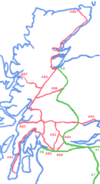
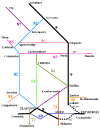
Zone 8
Introduction
The roads of Zone 8 are a little different to the mainstream. They cover some of the wildest, most remote and empty parts of the British Isles, namely the Western Highlands and Islands of Scotland. This page aims to give a little more information on some of the points mentioned in the route descriptions of the A and B roads in Zone 8.
The Roads
The A-Roads
To start with, a little history. In 1922, when the original list of A-roads was published, there were just 70 A-roads for Zone 8. The A8, A80-88 and A800-859. The A8 was given the important job of linking Scotland's two major cities together, and the A80-88 fanned out across the country working northwards, with the A82 having the second most important job of linking Glasgow with Inverness.
- A8 Edinburgh - Glasgow - Gourock
- A80 Glasgow - Stirling
- A81 Glasgow - Callander
- A82 Glasgow - Inverness
- A83 Tarbet - Campbeltown
- A84 Stirling - Lochearnhead
- A85 Dundee - Oban
- A86 Kingussie - Spean Bridge
- A87 Invergarry - Kyle (Skye Ferry)
- A88 Inverness - Thurso
The 3-digit roads covered the zone as follows in 1922:
- A800-A814 North Glasgow, southern Stirlingshire and Dunbartonshire
- A815-A819 South west Argyll (Cowal to Oban)
- A820-A829 From A9 west to north Argyll coast.
- A830 The odd one out, running then as now from Fort William to Mallaig
- A831-A835 West of Inverness/ Ross-shire
- A836-A840 Sutherland and Caithness
- A841-A843 Arran (Rationalised)
- A844-A845 Bute (Rerouted)
- A846-A847 Islay & Jura
- A848-A849 Mull (Rerouted)
- A850-A856 Skye
- A857-A859 Lewis (Rerouted)
And that was it.
Almost immediately roads were added to the system, with some approximate dates given:
- A860 Great Cumbra Isle (defunct) (1923/4)
- A861 Ardgour & Sunart, Drumsallie-Salen (1923/4)
- A862 East Loch Ness, Inverness-Fort Augustus (1924/5, now defunct)
- A863/A864 Skye, near Dunvegan (A864 Defunct)
- A865-A868 Additional routes in Western Isles (1925/6)
- A869-A871 Colonsay (1925/6, now defunct)
- A872-A879 Stirling, Dunbarton & North Glasgow area (1926/7 - A876 allocated in 1927)
- A880-A899 Returning to Argyll & Highland Counties (A896 allocated by 1932)
By 1935, when the great re-numbering took place, many of these routes had already been changed, or were changed at that time, notably on Arran where the numbers were rationalised before 1932.
The B-Roads
There were, of course, many B-roads marked out in those very early years, with most of the numbers from 800-899 and 8000-8077 having been used by the mid 1930s. However, there were initially only 99 identified in the original 1922 lists. As with the A roads, these spread out from Edinburgh across the west of Scotland and Highlands, before moving onto the islands, roughly as follows:
- B800-B829 - Spread out from West Lothian across Stirlingshire and Glasgow
- B830-B845 - Dumbartonshire and then across Argyll from Cowal to Kintyre and then north towards Oban.
- B846-B848 - Perthshire and Dalwhinnie
- B849/50 - Back to Argyll, for Ardgour and Morvern
- B851-B854 - Loch Ness and Inverness
- B855-B860 - Wester Ross and Ullapool
- B861-B866 - Easter Ross and Inverness
- B867-B876 - Sutherland and Caithness
- B877-B881 - Bute
- B882 - Mull
- B883-B887 - Skye
- B888-B898 - Western Isles
The B899 was added very soon, presumably at the same time as the A860, as they are the two roads on the Isle of Cumbrae. Another wave of roads then seem to have been added soon after, with the B8000-3 spread across Argyll, and the B8004-7 grouped in Lochaber, but the B8008 was near Inverness. The B8009 was on Skye, and then the B8010-B8015 on the Isle of Lewis.
Beyond that, the numbers seem to have been allocated less consistently, with a lot of numbers quickly recycled as routes were upgraded to A roads - for instance, the original B801 in Airdrie was upgraded to the A8010, leaving the number free to be reused hundreds of miles away at Kinlochbervie in Sutherland.
History
Links & Pier Roads
Of the first 60 A8xx roads allocated, no less than 11 were less than 2 miles long, forming short links in towns, or to piers. Indeed, all of the A851-A855 group on the Isle of Skye were short spurs serving piers (or the village next to a pier).
- A812-A813 at Balloch
- A817-A818 Lochgilphead/Campbeltown
- A824-A825 Auchterarder / Crieff
- A840 Thurso
- A852-A855 Skye
Of the Additional routes allocated, there were even more short links:
- A864 on Skye
- A868 Tarbert Ferry Spur on Harris
- A872 Corran Ferry Spur - 100m long at most!
- A874 Another link near Balloch
- A877 Half a mile or so in Renfrew
- A878 A spur near the Erskine Bridge (may not be the original use)
The theme of Pier roads was greatly extended with the B-roads If we close in on Lochaber, the area to the south and west of Fort William, there were originally 8 B-roads, as follows:
- B849 Running to the pier on the Sound of Mull at Drimnin
- B850 Running to the pier at Kinlochmoidart (swallowed by A861)
- B8004 Following the Caledonian Canal
- B8005 Running to the pier at the end of Loch Arkaig
- B8006 Running to the pier on Loch Shiel at Dalelia (defunct)
- B8007 Running to the Pier at Kilchoan
- B8043 Following the coast of Kingairloch
- B8044 Running to the Pier at Ardtoe on Kentra Bay
I suspect that you can see the theme. 6, or 75% of these roads termiate at Piers, a statistic which probably matches the rest of the zone, with the exception of Caithness and eastern Sutherland, where the A88 (now A9) follows the coast, and the B-roads run in land.
On the Isle of Skye, there were six B-roads in the 1960s, four of which terminated at piers. On the Uists, there were six B-roads, five of which terminated at Piers, and the B892 looped round the west of Benbecula, no doubt serving several piers along the way.
What was the importance of the piers in Zone 8?
The crucial question seems to be, why does the pier seem to be of prime importance in rural Zone 8?
Tha answer is simpler than you may expect.
Basically, while roads existed on the mainland, and were well used, the primary form of transport in Argyll and the Highland Counties until the 1950s was by sea. Most of the largest settlements were on the coast, or set on freshwater lochs, and many relied on fishing for their survival. In the islands this situation was even more pronounced - hence why Harris and the Uists didn't receive any A-roads in the initial list. The boat was king, and with steamers sailing out of Glasgow and Oban to almost every small pier imaginable, as well as a flotilla of small local coastal steamers, it was inevitable that the MOT saw the pier as the source not the destination of most traffic. Obviously, by 1970 this situation had reversed completely, and so we are now left with so many roads to nowhere scattered across the western seaboard that some of them have almost become a joke. Fortunately, many of the A roads (notably on Skye) and a few B-roads have been de-classified, but there are three B-roads in Lochaber that really do not warrant their status, namely the B849, B8005 and B8044.
| Zone 8 | ||
| ||
|

