File:Before M876.jpg

Original file (1,205 × 843 pixels, file size: 443 KB, MIME type: image/jpeg)
| ||||||||||||||
|
Galleries | M80 | M876 | A876 | A80 | Bankhead Interchange | Bartholomews Mapping | ||
File history
Click on a date/time to view the file as it appeared at that time.
| Date/Time | Thumbnail | Dimensions | User | Comment | |
|---|---|---|---|---|---|
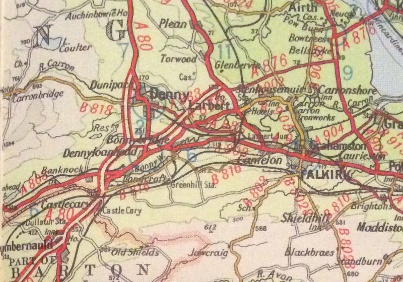
| current | 18:16, 17 December 2015 | | 1,205 × 843 (443 KB) | Duncan macknight (talk | contribs) | Taken from a 1965 road map showing the dual carriageway A876/A80 before the motorway were added. When the M80 was extended north, the A876 was upgraded to motorway until J2 with the later section completed in the early 80s. |
File usage
The following 3 pages use this file:
- Bankhead Interchange
- File:Before M876 (file redirect)
- Gallery:Junctions in Scotland