Bakewell
Jump to navigation
Jump to search
| Bakewell | |||
| Location Map ( geo) | |||
 | |||
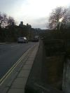
| Bridge over the River Wye in Bakewell | |||
| |||
| County | |||
| Derbyshire | |||
| Highway Authority | |||
| Derbyshire | |||
Bakewell is a town in the Peak District of Derbyshire, famous for its puddings, and a popular tourist destination. Settlements go back to the Romans, and it owes its location to the crossing of the River Wye, initially by fords but since medieval times by a bridge. Bakewell Bridge is a five-arched stone bridge, and at around 800 years old is said to be one of the oldest bridges in the country still in use.
Bakewell lies on the A6 which still passes through the centre of town approximately on its historic route southwest of the River Wye. Bakewell Bridge is now part of the A619 route over the river to Chesterfield.
There were bypass proposals in 1936 and the 1950s / 1960s. See Link for the history.
Routes
| Route | To | Notes |
| Buxton | ||
| Matlock | ||
| Chesterfield | ||
| Monyash | ||
| Hathersage |
Links
| Bakewell | ||||||||
| ||||||||
| ||||||||
| ||||||||
|


