Star.pngStar grey.pngStar grey.pngStar grey.pngStar grey.png

R829

From Roader's Digest: The SABRE Wiki
Jump to navigation Jump to search
R829
Location Map ( geo)
Cameraicon.png View gallery (2)
From:  Monkstown (O231286)
To:  Dalkey (O263270)
Via:  Glenageary
Distance:  4.3 km (2.7 miles)
Meets:  R119, R830, R118
Highway Authorities

Dún Laoghaire - Rathdown County

Traditional Counties

Dublin

The R829 is a loop off the R119 Blackrock to Bray road between Monkstown and Dalkey in Dún Laoghaire.

An image has been requested for this article.


R829
Places
Related Pictures
View gallery (2)
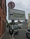
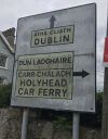
Dalkey old sign 4.jpgDalkey old sign 1.jpg
Other nearby roads
Dún Laoghaire
E105 (Dublin - Rosslare) • E122 (Old System) • N11 • N31 • R116 • R118 • R119 • R830 • R831 • R832 • T44
R800-R899
R800 • R801 • R802 • R803 • R804 • R805 • R806 • R807 • R808 • R809 • R810 • R811 • R812 • R813 • R814 • R815 • R816 • R817 • R818 • R819
R820 • R821 • R822 • R823 • R824 • R825 • R826 • R827 • R828 • R829 • R830 • R831 • R832 • R833 • R834 • R835 • R836 • R837 • R838 • R839
R840 • R841 • R842 • R843 • R844 • R845 • R846 • R847 • R848 • R849 • R850 • R851 • R852 • R853 • R854 • R855 • R856 • R857 • R858 • R859
R860 • R861 • R862 • R863 • R864 • R865 • R866 • R867 • R868 • R869 • R870 • R871 • R872 • R873 • R874 • R875 • R876 • R877 • R878 • R879
R880 • R881 • R882 • R883 • R884 • R885 • R886 • R887 • R888 • R889 • R890 • R891 • R892 • R893 • R894 • R895 • R896 • R897 • R898 • R899
Earlier incarnations : R861

SABRE - The Society for All British and Irish Road Enthusiasts
Discuss - Digest - Discover - Help