File:Cheshire Area Road Network Outline Proposals 16 Jan 1970.jpg
Jump to navigation
Jump to search

Size of this preview: 480 × 599 pixels. Other resolution: 515 × 643 pixels.
Original file (515 × 643 pixels, file size: 173 KB, MIME type: image/jpeg)
| |||||||||||||||||||||||||
|
Galleries | M53 | M56 | A55 | Cheshire | Chester | Ellesmere Port | ||
File history
Click on a date/time to view the file as it appeared at that time.
| Date/Time | Thumbnail | Dimensions | User | Comment | |
|---|---|---|---|---|---|
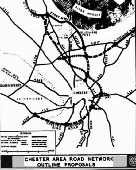
| current | 20:38, 10 March 2021 | | 515 × 643 (173 KB) | Ross spur (talk | contribs) | A plan of the Chester and South Wirral road proposals at January 1970 |
File usage
The following 2 pages use this file: