Fingal County Council
Jump to navigation
Jump to search
| Fingal County Council Comhairle Contae Fhine Gall | |||
| Location Map ( geo) | |||
 | |||
| Fingal County Hall, Swords | |||
| |||
| County | |||
| Dublin | |||
| Terminal & Intermediate Destinations | |||
| Dublin Airport | |||
| Borders | |||
| Dublin City • Kildare • Meath • South Dublin | |||
| Transport Infrastructure Ireland Roads | |||
| M1, M2, M3, M50, N2, N3 | |||
Fingal County Council is the authority responsible under the Road Traffic Act 1961 for the planning, construction, and maintenance of all public roads in the northern part of County Dublin other than national roads (including motorways), which are the responsibility of Transport Infrastructure Ireland.
The council's main offices are situated at County Hall, Main Street, Swords.
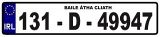
Motor vehicle index marks issued in the Dublin registration district (which includes the Fingal County Council area) incorporate the letter D.
Roads
Note that the distances stated below relate to the whole length of the routes concerned, both within and without the local road authority's boundaries:
| Route | From | To | Length |
|
|---|---|---|---|---|
| R102 | Blanchardstown | Malahide Road, Dublin | 10.9 km | View |
| R104 | Finglas | Kilbarrack | 12.8 km | View |
| R105 | Dublin (Eden Quay) | Howth | 22.1 km | View |
| R106 | Sutton | Swords | 13.9 km | View |
| R107 | Dublin (Clontarf Road) | Malahide | 10.5 km | View |
| R108 | Dublin | Drogheda | 49.7 km | View |
| R121 | Lucan | Skephubble | 19.1 km | View |
| R122 | Meakstown | Balbriggan | 30.8 km | View |
| R123 | Maynetown | Balgriffin | 2.8 km | View |
| R124 | Snugborough | Malahide | 4.6 km | View |
| R125 | Swords | Kilcock | 46.2 km | View |
| R126 | Lissenhall | Portraine | 8.2 km | View |
| R127 | Blakes Cross | Balbriggan | 17.7 km | View |
| R128 | Lusk | Skerries | 11.9 km | View |
| R129 | Coldwinters | Wyanstown | 9.6 km | View |
| R130 | Coolquoy Common | Grallagh | 18.2 km | View |
| R132 | Dublin | Carrickcarnan (border) | 98.7 km | View |
| R135 | Dublin | Rath, Ashbourne | 21.4 km | View |
| R139 | Clonshaugh | Baldoyle | 6.9 km | View |
| R147 | Dublin | Derver | 83.1 km | View |
| R149 | Leixlip | Clonee | 8.0 km | View |
| R806 | Blanchardstown | Manor Street, Dublin | 8.1 km | View |
| R809 | Raheny | Baldoyle | 7.1 km | View |
| R836 | Miltonsfields | Newtown | View | |
| R843 | Blanchardstown Road South | Blanchardstown Road North | 4.4 km | View |
Junctions
Main Article: Fingal County Council (Junctions)
Bridges, Tunnels, and other Crossings
Main Article: Fingal County Council (Crossings)
Links
| Fingal County Council | ||||||
| ||||||
| ||||||
| ||||||
| ||||||
|