Cork City Council
| Cork City Council Comhairle Cathrach Chorcaí | |||
| Location Map ( geo) | |||
 | |||
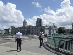
| Cork City Hall – as seen from the Parnell Bridge over the River Lee | |||
| |||
| County | |||
| Cork | |||
| Terminal & Intermediate Destinations | |||
| Cork | |||
| Borders | |||
| Cork County | |||
| Transport Infrastructure Ireland Roads | |||
| N8, N20, N22, N27, N40 | |||
Cork City Council is the authority responsible under the Road Traffic Act 1961 for the planning, construction, and maintenance of all public roads in the City of Cork other than those forming part of the national road network – motorways, national primary, and national secondary routes – which are the responsibility of Transport Infrastructure Ireland.
In 2006 Cork City Council put forward a proposal which would have increased the city's area considerably, from 3,961 to 18,170 ha and the population from 119,100 (in 2006) to c. 180,000. However, no action had been taken on this plan by the time that the Local Government Reform Act 2014 came into force; indeed, Cork City was the only Irish local authority area excluded from any form of reorganization under the Act.
The council's main offices are at City Hall, Anglesea Street, Cork.
Motor vehicle index marks issued in the Cork registration district (which includes the Cork City Council area) incorporate the letter C.
Roads
| Route | From | To | Length |
|
|---|---|---|---|---|
| R608 | Washington Street, Cork | Barnagore | 12.2 km | View |
| R610 | Cork | Raffeen | 11.8 km | View |
| R614 | Cork | Rathcormack | 29.9 km | View |
| R615 | Tinker's Cross | Riverstown | 3.2 km | View |
| R635 | Blackpool, Cork | Tivoli, Cork | 4.7 km | View |
| R641 | Cork | Cork South Ring | 2.0 km | View |
| R846 | Mardyke, Cork | Blackpool, Cork | 3.3 km | View |
| R847 | Christy Ring Bridge, Cork | UCC Lee Maltings | 1.5 km | View |
| R848 | Grand Parade, Cork | South end of Parnell Bridge | 0.38 km | View |
| R849 | Bandon Road, Cork | South Ring, Cork | 3.2 km | View |
| R851 | Barrack Street, Cork | Ballycurreen Cross | 7.0 km | View |
| R852 | South City Link, Cork | Ballinure | 5.6 km | View |
| R853 | Douglas, Cork | Blackrock Castle | 3.3 km | View |
| R854 | Lower Glanmire Road, Cork | Saint Patrick's Bridge, Cork | 0.53 km | View |
Note that the distances stated above relate to the whole length of the routes concerned, both within and without the local road authority's boundaries
Junctions
Bridges, Tunnels, and other Crossings
Links
| Cork City Council | ||||||
| ||||||
| ||||||
| ||||||
| ||||||
|
