R108
| R108 | ||||||||||
| Location Map ( geo) | ||||||||||
| ||||||||||
| From: | Dublin (O151339) | |||||||||
| To: | Drogheda (O092750) | |||||||||
| Via: | Dublin Airport, Naul | |||||||||
| Distance: | 49.7 km (30.9 miles) | |||||||||
| Meets: | R137, R810, R148, R804, R135, R102, R103, R104, M50, R122, R125, R129, R122, R150, R152, R132 | |||||||||
| Highway Authorities | ||||||||||
| Traditional Counties | ||||||||||
| Route outline (key) | ||||||||||
| ||||||||||

The R108 forms the more westerly of the two routes between Dublin and Drogheda. It is second to the busier R132, and while that road had the honour of once being part of the main N1, at first glance the R108 appears to have less to show for itself.
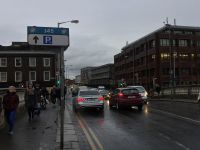
In fact the first few hundred yards of the R108, where it starts at a busy signalised junction with the R137 in the Christchurch area of Dublin, passes through the medieval city where the "five great roads" converged. The Slige Midluachra towards Ulster runs roughly parallel (via St Augustine Street) to this section of R108.
Considering this history, it is perhaps a shame that the start of the R108 is so undignified, being a mixture of D3 and S4. In 1965 it was first proposed to widen the road, with a large roundabout outside the cathedral.
In 1973 the Western Tangent would have demolished the whole area, in what was promoted as a regeneration. High Street would have run over the top of it on a dual carriageway flyover. When this scheme was postponed, it was suggested that High Street be upgraded to temporarily become the main road. That temporary arrangement became permanent. This section of the road is now part of the Dublin Inner Orbital Route.
After descending the steep hill on Bridge Street, the road crosses the historic Father Mathew Bridge, and enters the Smithfield area. This is another area which fell into decline during the 20th Century, which did at least allow for some more road improvements along Constitution Hill. The large junction at North King Street shows that we are crossing the failed Inner Tangent, and the dual carriageway from here was intended to be a major route out of town.
At the new Luas crossing in Broadstone, the road used to give way to the N2; the highest numbering honour this road gets. The N2 is now R135, and it is widely accepted that the R108 still loses priority here, even though the signage is ambiguous about it. The two roads climb into Phibsborough, over Cross Guns Bridge (the site of the former Glasnevin Station) to the gyratory at Hart's Corner, where they go their separate ways.
The R108 turns more leafy in nature now it's in the suburbs. It crosses the Tolka on Dean Swift Bridge. Trees in this area have been proposed to be removed to widen the road under the BusConnects scheme, which has proven controversial.
After another gyratory at Griffith Avenue, the road returns to dual carriageway. It now heads up towards the M50 via the middle of Ballymun. This area had a poor reputation, mostly because of its 1970s appearance, but has now been turned around. Shiny offices line the road while the large D3 has been heavily traffic calmed - an unusual combination - and especially odd when not all the buildings have been sold yet!
As it nears the M50, there is plenty of space for new retail parks, including the IKEA site on the R104 and Gulliver's on Northwood.
Shortly after the M50, the ruler-straight road encounters several deviations. This is to get around the two runways at Dublin Airport. In between them, it briefly returns to its original alignment to serve several airport facilities, including its fire station. This takes it up to the Kingstown Cross Roads.
Beyond here, the road becomes rather less eventful and more rural in character. It manages to totally avoid Swords and instead serves Ballyboughal and Naul, eventually meeting its long-lost cousin, the R132, by the River Boyne in Drogheda. Here it gives way and lets the former N1 continue the journey towards Belfast.


