N2
| N2 | |||||||||||||
| Location Map ( geo) | |||||||||||||
 | |||||||||||||
| From: | Dublin (Balseskin) (O125404) | ||||||||||||
| To: | Moy Bridge (border) (H662510) | ||||||||||||
| Via: | Ardee, Monaghan | ||||||||||||
| Distance: | 133 km (82.6 miles) | ||||||||||||
| Meets: | M50, R135, R152, R153, R150, N51, R168, R169, R165, R170, N33, N52, R171,R181, R183, N53, R184, R214, R213, N54, N12, A5 | ||||||||||||
| Primary Destinations | |||||||||||||
| Highway Authorities | |||||||||||||
| Traditional Counties | |||||||||||||
| Route outline (key) | |||||||||||||
| |||||||||||||
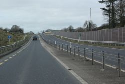
The N2 is the main road running north-northwest of Dublin to Monaghan, beyond which it connects at the border with the A5 to Derry.
Route
The N2 starts at the Finglas Interchange M50 J5 and runs northwest past the Airport logistics park. The first 4.5 km of the route is D3 HQDC to J2 with the R135, where there is a lane drop and the route continues for 13 km as the D2M M2, which crosses into County Meath and bypasses Ashbourne. The M2 ends at the Rath Roundabout, 2 km north of the town, and the original course of the road, now the R135, rejoins from the right.
The N2 continues from Rath Roundabout in a straight line northwest. After 2 km it crosses briefly into Co. Dublin for 1 km and after a further 1 km the R155 joins at a traffic-light-controlled junction, a rarity on rural Irish roads. A further kilometre on, the R152 to Duleek branches off to the right. The route then continues more or less straight across the flat Meath countryside, with junctions with the R153 and R150.
Approaching Slane, the N2 descends into the Boyne valley, a relatively gradual decline from the south. At Slane, the narrow 18th century bridge across the Boyne has an alternate one way system. On the northern side there is a steeper gradient, and and a bend just before the traffic light controlled crossroads with the N51 at the centre of Slane. Southbound traffic at Slane is filtered by a traffic control system that segregates HGV and car traffic, allowing faster traffic proceed first. There have been numerous examples of large southbound vehicles crashing into the bridge parapet at the base of the hill. A bypass for Slane with a high level bridge is currently being designed.
North of Slane the countryside is less flat and the road is less straight. 11 km north of Slane the route crosses into Co. Louth and passes uphill along the main street of Collon. 1 km north of Collon the R169 provides a convenient route for northbound traffic to the M1.The N2 continues for 8 km to Ardee. The N52 joins from the right half way up the main street. The N52 formerly had a short multiplex to the north of the town and branched off for Dundalk, but has now been downgraded, although signage does not reflect this. The N33 - which today carries the majority of traffic from Dublin via the M1 joins at a roundabout north of the town. The N2 carries on North-West as modern Irish S2 with hard shoulders, crossing into County Monaghan over a modern bridge at Aclint. Carrickmacross is bypassed by a high quality S2 with a GSJ at either end of the town and a which is crossed by the R179 on a flyover. A further 13 km brings us to a roundabout with the N53 on the southern outskirts of Castleblayney. The N2 continues as a D2+1 to bypass the town with GSJ junctions with the R181 and R183.
After a further 18 km of 2+1 the N2 continues as regular S2, with some climbing lanes, towards Monaghan, veering to the left as it approaches the town. Monaghan is bypassed to the east by a modest bypass, at the end of which the N12 and N54 run right and left, respectively.
After this, the N2 heads north towards the border with Northern Ireland. The first part of this route has some of the poorest sections of the N2, despite recent removal of bends, but north of Emyvale better S2 with shoulders is found. The N2 ends at the modern Moy Bridge, 1.5 km south of Aughnacloy, and the A5 continues on across County Tyrone to reach Omagh, Strabane, and Derry.
History
Until 2012, the road began on Dorset Street Upper in Dublin city centre. It then took two routes: outbound via Western Way and Phibsborough Road, inbound via Berkeley Road and Blessington Street. These convoluted routes were intended to be temporary until Parnell Street was upgraded.
The two arms met at Doyle's Corner, and then continued past Hart's Corner to Finglas. Beyond Glasnevin, the road opened up to dual carriageway, but remains deeply urban in nature.
As it neared Finglas village, the road moved onto a bypass and headed under a flyover. This took us up to the present start by the M50. This whole route is now designated R135.
Planned Improvements
Slane Bypass
Video campaigning about N2 safety
Ardee to Aughnacloy
Links
Irish Statute Book
- Roads Act 2007 (Declaration of Motorways) Order 2009 - This instrument converts the following sections of the N2 to motorway: Killshane to Ashbourne
Irish Roads
Meath County Council
TII
- Jacobs: Preferred Route Corridor - Main Layout Plan (Clontibret to Aughnacloy) February 2021 (archive.org)
Monaghan County Council


