Kelvinhaugh Bridge
Jump to navigation
Jump to search
| Kelvinhaugh Bridge | |||
| Location Map ( geo) | |||
 | |||
| |||
| From: | Finnieston | ||
| To: | Partick | ||
| Location | |||
| Kelvinhaugh | |||
| County | |||
| Lanarkshire | |||
| Highway Authority | |||
| Glasgow | |||
| Opening Date | |||
| 1960s, c2008 | |||
| Additional Information | |||
| |||
| On road(s) | |||
| A814 | |||
| Crossings related to the A814 | |||
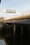
The Kelvinhaugh Bridge is really two bridges, running parallel to each other across the River Kelvin on the west side of Glasgow. The older bridge carries the D2 A814 Clydeside Expressway, while the newer bridge carries the S4 local access road called Castlebank Street. Immediately upstream another bridge crosses, carrying a railway line.
The bridges are very similar to one another, both being steel girder bridges carrying a concrete deck. However, while the A814 bridge has two spans, supported by concrete legs, the new bridge crosses in a single span, by using slightly deeper beams.
| Kelvinhaugh Bridge | ||||||
| ||||||
|


