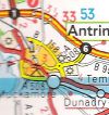
Antrim
Jump to navigation
Jump to search
| Antrim | |||
| Location Map ( geo) | |||
| |||
| County | |||
| Antrim | |||
| Forward Destination on | |||
| M2, A6, M22, A26, (A31) | |||
| Next Primary Destinations | |||
| Ballymena • Belfast • Belfast Airport • Cookstown • Derry | |||
This article is about the town and Primary Destination.
For the County, see County Antrim.
For the County, see County Antrim.
Routes
| Route | To | Notes |
| Belfast, Larne | ||
| Londonderry, Cookstown | ||
| Randelstown | ||
| Belfast, Templepatrick, Larne (A8) | A8 to Larne via A57 | |
| Ballymena, Coleraine | ||
| International Airport, Nutts Corner, Craigavon, Lisburn (B101), Crumlin (A52) | ||
| International Airport, Crumlin, Glenmount Campus (CAFRE) | ||
| old A6 through the town | ||
| Loanends, Belfast (A52), Old Mill Business Park | ||
| Parkgate, Ballyclare, Dunadry | ||
| forms a distributor around the town | ||
| Ballymena, Coleraine | unsigned, uses A26 | |
| Belfast, Larne | unsigned, uses M2 | |
| Londonderry, Cookstown | unsigned, uses M22 | |
| International Airport, Craigavon, Lisburn (B101), Crumlin (A52) | unsigned, uses A26 | |
| Londonderry, Cookstown | unsigned, uses M22 | |
| Belfast, Larne | unsigned, uses M2 | |
| Parkgate | now A6 and B95 | |
| International Airport, Crumlin, Glenmount Campus (CAFRE) | was A26 now A57 | |
| Coleraine, Ballymena, Londonderry (M23) |


