Newry
Jump to navigation
Jump to search
| Newry An tIúr | |||
| Location Map ( geo) | |||
 | |||
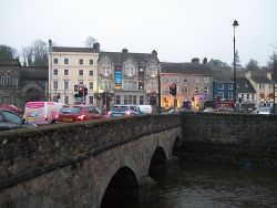
| Morning rush hour on Sugar Island Bridge | |||
| |||
| County | |||
| Armagh • Down | |||
| Forward Destination on | |||
| A1, A2, A27, A28, (N1) | |||
| Next Primary Destinations | |||
| Armagh • Craigavon • Lisburn • Warrenpoint | |||
| Other Nearby Primary Destinations | |||
| Downpatrick | |||
| Next Terminal & Intermediate Destinations | |||
| Dundalk | |||
| Places related to the A1 (Northern Ireland) | |||
| Places related to the A2 (Northern Ireland) | |||
Larne • Belfast • Newcastle (County Down) • Warrenpoint • Coleraine • Derry • Ballycastle • Carrickfergus • Bangor (County Down) • Letterkenny • Newtownabbey • Limavady • Kilkeel • Portrush • Strangford • Portaferry • Portstewart • Culmore • Buncrana | |||
| Places related to the A27 (Northern Ireland) | |||
| Places related to the A28 (Northern Ireland) | |||
Newry is a city in Northern Ireland near the border with the Republic of Ireland on the Belfast to Dublin route. The city lies almost equally between County Armagh and County Down, with the river running through the middle acting as the division between the two counties. In common with the rest of the six counties forming Northern Ireland, roads are managed by DfI Roads.
Routes
| Route | To | Notes |
| Belfast, Banbridge | ||
| Dublin, Dundalk | ||
| Warrenpoint, Heysham lorry ferry | ||
| Craigavon, Portadown, Tandragee, Jerrettspass, Poyntzpass | ||
| Armagh, Markethill | ||
| Camlough, Newtownhamilton | ||
| Downpatrick, Rathfriland | ||
| Downpatrick, Hilltown | ||
| Silverbridge, Crossmaglen, Castleblayney | ||
| Omeath, Carlingford | ||
| Forkhill | ||
| Mountnorris, Markethill | ||
| Belfast, Banbridge | unsigned, uses A1 | |
| Dublin, Dundalk | unsigned, uses A1 | |
| Armagh, Markethill | unsigned, uses A28 | |
| Warrenpoint, Heysham lorry ferry | unsigned, uses A2 | |
| Craigavon, Portadown, Tandragee, Jerrettspass, Poyntzpass | unsigned, uses A27 | |
| Belfast, Banbridge | unsigned, uses A1 | |
| Dublin, Dundalk | unsigned, uses A1 | |
| Belfast, Banbridge | ||
| Dublin, Dundalk | ||
| Belfast, Banbridge, Lisburn |


