B101 (Northern Ireland)
| B101 | |||||||
| Location Map ( geo) | |||||||
| |||||||
| From: | Lisburn (J256653) | ||||||
| To: | Nutts Corner (J195778) | ||||||
| Via: | Dundrod | ||||||
| Distance: | 9.4 miles (15.1 km) | ||||||
| Meets: | A30, A513, A519, A501, B38, B154, A52, A26 | ||||||
| Old route now: | A26 | ||||||
| Primary Destinations | |||||||
| Traditional Counties | |||||||
| Route outline (key) | |||||||
| |||||||
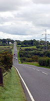
The B101 is a cross-country road in south County Antrim forming part of the direct route between Lisburn and Belfast International Airport. The road was originally unclassified but gained its number in the mid-1920s.
The road starts at a TOTSO on the A30 to the north of Lisburn city centre and heads north along Pond Park Road to a T-junction on the A513, where traffic is forced to turn left; all other movements are allowed. Before the A-road was built the B101 simply continued ahead but there is now no access in that direction; instead there's a short multiplex to the west and the B101 reappears by turning right at a roundabout to enter a modern housing estate. We TOTSO right then left to rejoin the direct line of the route.
Heading north, we soon enter open country and then climb into the hills. Presently a crossroads on the A501 is met and there's a short multiplex to the left until that road TOTSOs left and the B101 continues ahead. We continue in a vaguely northerly direction across undulating terrain before being crossed by the B38.
The road now descends into Dundrod and reaches a crossroads, where it TOTSOs left to cannon off the B154. The Crumlin River is then crossed, after which we run across a final flat section through the industrial estate that has grown up around the carcase of the former Belfast Nutts Corner Airport. The road ends at the Nutts Corner roundabout, where it meets the A52 and A26.
Originally the B101 continues ahead via Killead to end on the B39 to the east of Antrim. However, Belfast's main airport was moved from Nutts Corner to Aldergrove in the 1960s and extension of the runway to form what is now Belfast International Airport severed the original line of the A26. That road was therefore rerouted along what was the B101 to the north of here.


