C43 (Inverclyde)
| C43 | ||||
| Location Map ( geo) | ||||
 | ||||
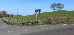
| The west end of the road at the B786 Lochwinnoch Road | ||||
| ||||
| From: | Pomillan (NS346669) | |||
| To: | Craigbet (NS369663) | |||
| Via: | Quarrier's Village | |||
| Distance: | 1.4 miles (2.3 km) | |||
| Meets: | B786, C43 (Renfrewshire) | |||
| Highway Authorities | ||||
| Traditional Counties | ||||
| Route outline (key) | ||||
| ||||
For other roads numbered C43, see C43.
The C43 is the main route through Quarrier's Village, starting on the B786 at Pomillan Bridge and running generally eastwards along Craigbet Road to Craigbet Bridge on the council Boundary. Most of the village, originally built as Homes for Orphans, lies to the north of the road, with large Victorian villas set in parkland overlooking the River Gryffe.
Route
Pomillan Bridge to Quarriers Village
The stretch of the road from Pomillan Bridge on the B786 Lochwinnoch Road to Quarriers Village is narrow and twisting, passing through sheep and cattle pasture on both sides. Houses are few and are located on the north side of the road, mostly near Hattrick Farm, which is on a bend at the top of a slight rise.
A Quarriers Village boundary sign is located around 200m from the village proper.
Quarriers Village
The former orphanage straddles the road, which widens to two lanes at the junction with the unclassified road to Craigends on the A761. Most of the village buildings are grand in scale and design and sit in manicured grounds. Most are now in private residential use, but the Quarriers charity still occupies some of them, including their head office which is located on the south side of the road.
A metal bridge carries the road over Gotter Water, before the former village fire station is passed on the right. Some modern houses are then passed on the left as the road climbs towards the east.
Quarriers Village to Renfrewshire Boundary
The road climbs out of Quarriers Village and passes the entrance to the former Bridge of Weir Hospital which stands on the right. The hospital buildings are now in residential use, including the former lodge houses which stand by the C43. The road drops down again shortly after passing the hospital and the fairly grand entrance to Craigbet House is passed opposite Hope Lodge.
Soon after, the Renfrewshire boundary is reached at Carruth Burn, around 400m before the junction with Torr Road.


