C18 (Inverclyde)
Jump to navigation
Jump to search
| C18 | ||||
| Location Map ( geo) | ||||
 | ||||
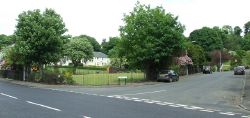
| The start of the road at the High Street in Kilmacolm | ||||
| ||||
| From: | Kilmacolm (NS357701) | |||
| To: | Council boundary (NS367704) | |||
| Via: | West Glen Road | |||
| Distance: | 0.7 miles (1.1 km) | |||
| Meets: | C36, C18 (Renfrewshire) | |||
| Highway Authorities | ||||
| Traditional Counties | ||||
| Route outline (key) | ||||
| ||||
This article is about the Class III road numbered C18 maintained by Inverclyde Council.
For other roads numbered C18, see C18.
For other roads numbered C18, see C18.
The C18 starts on the High Street in Kilmacolm, and follows West Glen Road north east to the council boundary just outside the small town.
Route
The road immediately climbs away from Kilmacolm where it starts as two lanes with parking bays on the south side of the road. After twisting and climbing out of the village and leaving the housing estates behind, the road becomes more rural in nature and is reduced to a single lane.


