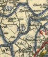
OSNI Mapping
Jump to navigation
Jump to search
| Pictures related to OSNI Mapping View gallery (6) |
The Ordnance Survey of Northern Ireland came into existence after the partition of Ireland. Today OSNI is part of the Land and Property Services Northern Ireland.
List of Maps
A list of the changes to Ordnance Survey of Northern Ireland mapping from 1921 to present.
| Year From | Year To | Map Name | Scale | Notes |
|---|---|---|---|---|
| 1910 | 19?? | One Inch Series | 1:63360 | |
| 19?? | 19?? | One Inch Popular Edition | 1:63360 | |
| 19?? | 197? | One Inch 3rd Edition | 1:63360 | |
| 19?? | present | OSNI Discoverer | 1:50000 | Shared with OSi |
Links
- RTÉ Archives: 32 County Road Atlas 22.04.1985 (archive.org)
| OSNI Mapping | ||||||||
| ||||||||
|


