OS Landranger
| Landranger | |||
 | |||
| |||
| Publisher: | Ordnance Survey | ||
| Scale: | 1:50,000 | ||
| First Published: | 1974 | ||
| SABRE Maps layer: | Yes | ||
In the early 1970s, the Ordnance Survey took the decision to relaunch their main mapping series in metric. The one-inch (1:63,360) Seventh Series maps, covering 45x40km, were replaced by the slightly larger 1:50,000 series, covering 40x40km.
In 1979 the series was rebranded as Landranger.
First Series
Most of the initial editions of the 1:50,000 mapping were known as First Series, and consisted of photographically enlarged one-inch material with colour changes. This was only ever envisaged as being an interim phase and so most sheets were moved to Second Series within five years - and indeed some sheets (such as the two London sheets and most Scottish sheets) never appeared as First Series at all.
It is often incorrectly stated that First Series sheets were simply reprints of the earlier Seventh Series data. This is incorrect, and all First Series sheets were revised from that original data.
1:50,000 sheets numbers 102-204, covering England and Wales south of the sheets that would include Preston and Hull were introduced simultaneously in 1974, replacing one-inch sheets 94-190 bar maps 98 and 99 (covering the Hull area) due to a small gap in coverage. 1:50,000 sheets 1-101 were published two years later in 1976, replacing one-inch sheets 1-93, 98 & 99.
Second Series
Second Series mapping differed from the original First Series with a new font and a new way of representing dual carriageways except on motorways.
The actual mapping used on the Landrangers is still very similar to the early Second Series sheets although as time progressed certain aspects were made clearer. However, into the 1990s computer plotting made it much easier to apply small changes across the range and print to a higher degree of accuracy and clarity.
Current Landranger mapping is still part of the Second Series (whose first sheets were published in 1974), and Ordnance Survey do not appear to have plans for a Third Series at this time.
Sheet List
Main Article:Landranger Sheet List
SABRE Maps coverage
Present day Landranger coverage is available on SABRE Maps at an appropriate zoom level. The earliest Landrangers were printed in 1974, and so will not be out of copyright until 1 January 2025. Historical Landranger coverage cannot, therefore, appear on SABRE Maps until that date.
However, work has begun on sourcing copies of the initial printings of every sheet ready for them to drop out of copyright.
Covers
The original 1:50,000 series retained the familiar style covers of the time similar to the one-inch maps, albeit in a magenta instead of red and a little larger to cover the slightly larger sheets. They retained the white spine, with GB sheet map on the white reverse, while the front had the familiar line drawing depicting the area covered by that map.
With the launch of the Landrangers, little changed. However in 1984 the maps were revolutionised by the addition of colour photos to the front. This saw the GB sheet map reduced in size on the reverse to allow room for a smaller 'area covered by' map. both of these had limited colour.
A further new design was launched for the Millenium, with some maps featuring 'Millenium Product' labels. This style, with minor changes, is still in use today. Silver has replaced the old white on the back cover, and the sheet map no longer covers the whole of GB, nearer a third of it, local to the particular sheet. More detail is now added to the 'area covered' map, with Long Distance Paths, National Parks, lakes and often high hills/mountains marked. The front retains a photo, larger than before, with a silver flash top right containing the sheet number. This style is similar to that used for the Explorers.
- OS Landranger covers
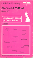
1970s
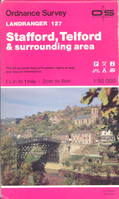
1980s
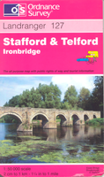
1990s
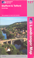
2000s


| OS Landranger | ||||||||
| ||||||||
|


