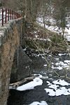
Kilmahog Bridge
| Kilmahog Bridge | |||||
| Location Map ( geo) | |||||
 | |||||
| From: | Kilmahog | ||||
| To: | Trossachs | ||||
| Location | |||||
| Kilmahog nr Callander | |||||
| County | |||||
| Perthshire | |||||
| Highway Authority | |||||
| Stirling | |||||
| Opening Date | |||||
| 1777 | |||||
| Additional Information | |||||
| |||||
| On road(s) | |||||
| A821 | |||||
| Crossings related to the A821 | |||||
| Crossings related to the Trossachs Trail | |||||
The bridge at Kilmahog is the furthest upstream crossing of the short River Teith. It connects the A821 Trossachs & Aberfoyle road with the A84, the junction of the two routes being just a hundred metres or so to the north of the bridge.
The Bridge
The bridge is a very basic two-arch stone bridge, with more recent iron railings on the low parapets. Substantial triangular cutwaters protect the pier and abutments, and these would have been important at a time when it was still common practice to float timber down rivers for sale. It is undated, but was built in 1777 with funds raised from the forfeiture of Highland Estates after the 1745 Jacobite Uprisings. Nearby Callander Bridge was paid for in the same way, as was Gartchonzie Bridge. Indeed Gartchonzie Bridge was built to the same design by the same mason, Peter McInnes from Crieff, as part of the same contract. That contract states that the roadway was 15 feet wide, with 3 foot high parapets. It was perhaps to widen the bridge that the parapets were replaced, as the bridge is now substantially wider than 15 feet, carrying two lanes of traffic flanked by pavements.
| Kilmahog Bridge | ||||||||
| ||||||||
|


