Star grey.pngStar grey.pngStar grey.pngStar grey.pngStar grey.png

T51

From Roader's Digest: The SABRE Wiki
Jump to navigation Jump to search
T51
Location Map ( geo)
Cameraicon.png View gallery (1)
From:  Kilcullen (N835088)
To:  Kilkenny (S509561)
Via:  Castledermot, Carlow, Paulstown
Now part of:  R448, N9, N10
Route outline (key)
T51 Kilcullen - Kilkenny

The T51 was a road that went from Kulcullen to Kilkenny via Carlow, as a diversion to the more direct T6.

The road became part of the N9 and N10. The construction of the M9 has caused some of this to be downgraded.


T51
Places
Related Pictures
View gallery (1)
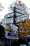
Kilkenny - Signs at intersection of R700 and N10 - Geograph - 1643604.jpg
Other nearby roads
Carlow
L7 • L31 • M9 (Republic of Ireland) • N9 • N80 • R417 • R430 • R448 • R725 • R726 • R728 • R888 • R924 • T16
Kilkenny
M9 (Republic of Ireland) • M10 (Republic of Ireland) • N10 • N76 • N77 • N78 • R693 • R695 • R697 • R700 • R702 • R712 • R713 • R886 • R887 • R909 • R910 • T6 • T14 • T19 • T20
Irish Trunk 'T' Roads (1922 - 1977)
T1·T2·T3·T4·T5·T6·T7·T8·T9·T10·T11·T12·T13·T14·T15·T16·T17·T18·T19

T20·T21·T22·T23·T24·T25·T26·T27·T28·T29·T30·T31·T32·T33·T34·T35·T36·T37·T38·T39
T40·T41·T42·T43·T44·T45·T46·T47·T48·T49·T50·T51·T52·T53·T54·T55·T56·T57·T58·T59
T60·T61·T62·T63·T64·T65·T66·T67·T68·T69·T70·T71·T72·T73·T74·T75·T76·T77

Spurs: T4A·T5A·T11A·T12A·T21A·T28A·T29A·T42B·T43A·T50A·T72A


SABRE - The Society for All British and Irish Road Enthusiasts
Discuss - Digest - Discover - Help