Star.pngStar grey.pngStar grey.pngStar grey.pngStar grey.png

T22

From Roader's Digest: The SABRE Wiki
Jump to navigation Jump to search
T22
T22.png
Cameraicon.png View gallery (1)
From:  Dundalk (J046079)
To:  Castleblayney (H828187)
Via:  Cullaville (NI)
Now part of:  N53, A37 (NI)
Route outline (key)
T22 Dundalk - Castleblayney

Route

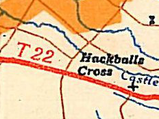
The T22 was the main trunk route between Dundalk and Castleblayney, straddling the border between Northern Ireland and the Republic.

When road numbers were revised in 1977, it became the N53.

The road has always included a section in Northern Ireland though Cullaville, which is the A37.


T22
Places
Related Pictures
View gallery (1)
T22.png
Other nearby roads
Dundalk
A1 (Northern Ireland) • A29 (Northern Ireland) • A37 (Cullaville) • E01 • E104 (Dublin - Killeen) • E118 (Old System) • E126 (Old System) • M1 (Republic of Ireland) • N1 • N52 • N53 • R132 • R171 • R172 • R173 • R177 • R178 • R215 • R934 • T1 • T9 • T23 • T24 • T62
Castleblayney
Irish Trunk 'T' Roads (1922 - 1977)
T1·T2·T3·T4·T5·T6·T7·T8·T9·T10·T11·T12·T13·T14·T15·T16·T17·T18·T19

T20·T21·T22·T23·T24·T25·T26·T27·T28·T29·T30·T31·T32·T33·T34·T35·T36·T37·T38·T39
T40·T41·T42·T43·T44·T45·T46·T47·T48·T49·T50·T51·T52·T53·T54·T55·T56·T57·T58·T59
T60·T61·T62·T63·T64·T65·T66·T67·T68·T69·T70·T71·T72·T73·T74·T75·T76·T77

Spurs: T4A·T5A·T11A·T12A·T21A·T28A·T29A·T42B·T43A·T50A·T72A

SABRE - The Society for All British and Irish Road Enthusiasts
Discuss - Digest - Discover - Help