Hazel Grove
| Hazel Grove | |||
| Location Map ( geo) | |||
 | |||
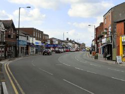
| The A6 passing through the village | |||
| |||
| County | |||
| Cheshire | |||
| Highway Authority | |||
| Stockport | |||
| Next Primary Destinations | |||
| Stockport • Buxton • Macclesfield | |||
| Other Nearby Primary Destinations | |||
| Manchester Airport | |||
| Other Nearby Destinations | |||
| Poynton • Alderley Edge • Wilmslow | |||
For the junction on the A3, see Hazel Grove Interchange.
Hazel Grove is a congested village on the A6 between Stockport and Buxton. At the Rising Sun junction, the A523 to Poynton and Macclesfield forks. A narrow S4 carriageway, seven signalized junctions with few right turn refuges and a further four pedestrian crossings make the village a notorious bottleneck on the A6.
Historically, the village was a very convenient stopping point for travellers in the 18th century to change horses, hence the large number of pubs, catering for their passengers. Trams used to operate down the A6 as far as Hazel Grove until 1949, whilst in modern times the village is now the terminus of the 192 bus route from Manchester.
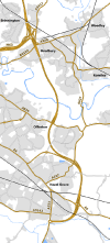
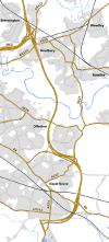
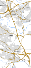
The south end of the village is the location of the temporary terminus of the A555 eastern extension, though the future of the continuation through to Bredbury and the M60 is uncertain.
Routes
| Route | To | Notes |
| Stockport, Manchester | ||
| Buxton | ||
| Macclesfield | ||
| Bramhall | ||
| Bredbury Marple (A626) |
Formerly B6103 | |
| Hazel Grove Station | ||
| Romiley | Now A627 | |
| Bredbury, Manchester (M60) | Eastern Route | |
| Stockport | Western Route | |
| Buxton | Disley and High Lane Bypass | |
| Manchester Airport | ||
| Bredbury (M60) | ||
| Woodford, Bramhall | Chester Road / Woodford Road from the A6 to the Stockport boundary | |
| Marple (unsigned) | Between the A6, along Commercial Road and Bean Leach Road to meet the A626 | |
| Dialstone Centre | Between the A6, along Dialstone Lane and Banks Lane to meet the A626 |


