SABRE Maps/Ten Mile Road Map coverage project
| SABRE Maps Coverage projects | ||
| Location Map ( geo) | ||
| Pictures related to SABRE Maps View gallery (47) | ||
| Quick Links | ||
| Coverage Projects overview Fifth Edition • New Popular Edition • Popular Edition • Scottish Popular • Seventh Series • Landranger • Half Inch • Ministry of Transport • Quarter Inch • Ten Mile & Route Planning • OSNI One Inch • 1:25k First Series | ||
| Related Terms | ||
| SABRE Maps Co-ordinate Finder • Sheetfinder Online Grid Calibrator Adding maps in depth Map layer names • Georeferencing | ||
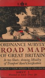
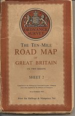
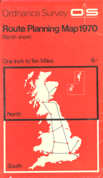
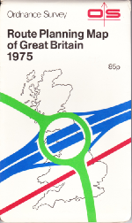
This SABRE Maps Coverage Project is to provide coverage of the Ten-Mile Road Map of Great Britain and the Ordnance Survey Route Planning Map series to SABRE Maps.
Not to be confused with the OS Ten Mile Map and its variants, these maps offered two-sheet coverage of the whole of Great Britain, showing as many road numbers as possible. Whilst nowhere near as detailed as other mapping, the Ten Mile (or 1:625,000) scale is an extremely useful overview of changes in the road network of Great Britain.
In addition to the historic mapping, this project will also endeavour to bring online full coverage of the OS Miniscale OpenData product first released in 2010, which is the nearest modern equivalent to the historic series in terms of an overview of the road network of Great Britain.
Finally, this project will track the Essential Traffic Routes mapping of military road numbers from World War 2, although this type of mapping is extremely rare.
Which projection type are these maps?
The initial batch of Ten Mile Road Maps from the 1930s to 1945 (plus, strangely, the 1947 edition) are laid out on the National Yard Grid.
With the exception of the aforementioned 1947 edition, all editions from 1946 onwards, including the Miniscale releases, use the OSGB National Grid.
Ten Mile Road Maps
Key
| Available on SABRE Maps | Online, but needs replacement source | Unconfirmed Revision | Within the pipeline | Pipeline (Military edition) |
Acquired but not scanned | Copy needed | In copyright (copy available) |
In copyright (copy needed) |
No map printed (or empty cell) |
| Year | Sheet 1 | Sheet 2 | Notes |
|---|---|---|---|
| 1932 | Revision code for both sheets is 5000/32 | ||
| 1933 | Revision code for Sheet 2 is 2000/33 | ||
| 1934 | Revision code for Sheet 1 is 2600/34, whilst Sheet 2 is 3600/34 | ||
| 1935 | Revision code for Sheet 1 is 800/35 | ||
| 1936 | Revision codes are 1536 for Sheet 1 and 2536 for Sheet 2 | ||
| 1937 | Revision code for Sheet 1 is 15/37. M.37. R.37, whilst Sheet 2 is 25/37. M.37. R.37 | ||
| 1938 | Revision codes are 1838.M38.R38 for Sheet 1 and 4038.M38.R38 for Sheet 2 | ||
| 1939 | Revision codes are 1539.M39.R39 for Sheet 1 and 2539.M39.R39 for Sheet 2 | ||
| 1940 | Revision codes are 1040.M39.R39 for Sheet 1 and 1540.M39.R39 for Sheet 2 | ||
| 1943 | Revision code for Sheet 1 is 2000/10/43 Ch, whilst Sheet 2 is 1500/10/43 Ch | ||
| 1944 | Revision code for Sheet 1 is 1544/Ch, whilst Sheet 2 is 2044/Ch | ||
| 1946 | Revision code is 25046. First to use National Grid. | ||
| 1947 | Revision code is 1000/12/47. Uses National Yard Grid. | ||
| 1948 | Revision code is 3817, and can only be easily differentiated from the 1946 map by this code, as all wording on the map says "correct to 1946". Return to using National Grid. | ||
| 1955 | Proofs only for the then-forthcoming 1956 edition without revision codes, with some changes made between proof and release, such as A259 to Dover. | ||
| 1956 | Revision codes are A. | ||
| 1963 | Revision codes are B. |
Route Planning Maps
Key
| Available on SABRE Maps | Online, but needs replacement source | Unconfirmed Revision | Within the pipeline | Pipeline (Military edition) |
Acquired but not scanned | Copy needed | In copyright (copy available) |
In copyright (copy needed) |
No map printed (or empty cell) |
| Year | Sheet 1 | Sheet 2 | Notes |
|---|---|---|---|
| 1964 | Revision codes are A. | ||
| Revision codes are A/. | |||
| 1965 | Revision codes are B. | ||
| Revision codes are B/*. | |||
| 1966 | Revision codes are C. | ||
| 1967 | Revision codes are D. | ||
| 1968 | Revision codes are E. | ||
| 1969 | Revision codes are F. | ||
| 1970 | Revision codes are G. | ||
| 1971 | Revision codes are H. | ||
| 1972 | Revision codes are J. | ||
| 1973 | Revision codes are K. | ||
| Revision codes are K/*. | |||
| 1974 | Revision codes are L. | ||
| 1975 | Revision codes are M. Not out of copyright until 1 January 2025. |
Notes
- From the 1965 edition onwards "Sheet 1" became "North Sheet" and "Sheet 2" became "South Sheet"
- The exact issuing of sheets from before 1946 is unknown at this time, and "No known source" is used when a map may have been issued. "Not issued" is only used for cases like 1948, when it is believed that no Sheet 1 was produced. As such, this is a guide only.
- Years are only included in the chart where there is a suggestion that the map may exist. If no evidence is found, then the year has been missed.
- From 1932, the maps used the National Yard Grid; whilst from 1946 the National Grid was used with the exception of the 1947 reprint.
OS Miniscale
Starting in 2010, Ordnance Survey released OS Miniscale across Great Britain as OpenData, and therefore this modern mapping can be used on SABRE Maps with appropriate attribution.
New revisions are released annually, but unfortunately Ordnance Survey Customer Services claim that each annual release simply overwrites the previous release across their servers, and they do not keep historical revisions. They are currently released in January each year.
SABRE Maps has the largest repository available of this mapping, with every revision released (up to January 2024) being available online.
Key
| Available on SABRE Maps | Online, but needs replacement source | Unconfirmed Revision | Within the pipeline | Pipeline (Military edition) |
Acquired but not scanned | Copy needed | In copyright (copy available) |
In copyright (copy needed) |
No map printed (or empty cell) |
| Year | Availability | Notes |
|---|---|---|
| 2010 | ||
| 2011 | ||
| 2012 | ||
| 2013 | ||
| 2014 | ||
| 2015 | ||
| 2016 | ||
| 2017 | ||
| 2018 | ||
| 2019 | ||
| 2020 | ||
| 2021 | ||
| 2022 | ||
| 2023 | ||
| 2024 |
Essential Traffic Routes
Military series GSGS 39938, with overprints on a standard Ten Mile Map outline base, similar to OS Ministry of Transport Road Map series. No copies of Sheet 2 have been found, and no copy of either sheet of the Third Edition have been found.
Please get in touch with us if you know the whereabouts of any of these maps.
Key
| Available on SABRE Maps | Online, but needs replacement source | Unconfirmed Revision | Within the pipeline | Pipeline (Military edition) |
Acquired but not scanned | Copy needed | In copyright (copy available) |
In copyright (copy needed) |
No map printed (or empty cell) |
| Year | Sheet 1 | Sheet 2 | Notes |
|---|---|---|---|
| 1939 | First Edition. Revision code for Sheet 1 is 5036 M39 R39 15/38 | ||
| 1940 | Second Edition. Revision code for Sheet 1 is 15/38 4200/40 | ||
| 1941 | Third Edition. No copies of any kind have a known location or revision code. Known only from the existence of a Fourth Edition | ||
| 1942 | Fourth Edition. Revision code for Sheet 1 is 7000/12/41 LR | ||
| 1943 | Fifth Edition. Revision code for Sheet 1 is 5040/4/43 LR |
