C20 (Renfrewshire)
| C20 | ||||
| Location Map ( geo) | ||||
 | ||||
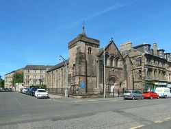
| The east end of the C20 (left of the church), at the junction with Broomlands Street, Paisley | ||||
| ||||
| From: | Paisley (NS473638) | |||
| To: | Linwood (NS446643) | |||
| Distance: | 2.5 miles (4 km) | |||
| Meets: | B7050, C74, A761 | |||
| Highway Authorities | ||||
| Traditional Counties | ||||
| Route outline (key) | ||||
| ||||
For other roads numbered C20, see C20.
The C20 starts on the B7050 near the centre of Paisley and heads north west through Ferguslie Park. It makes a sharper than 90 degree left turn immediately after passing under the A737, from where it heads south west to join the A761 in Linwood.
Route
Paisley Town
The route starts on King Street at Broomlands Street at the east end of Paisley town centre. Broomlands Street is a busy commercial street with fairly heavy Traffic. King Street is different, being suburban in nature from the off-set.
A substantial flyover carries King Street high above the B775, Gallow Green Road, which forms part of the Paisley ring road.
Paisley Woodside cemetery and crematorium, with its mature trees, gives the road an almost rural atmosphere until suburbia kicks in again as the road crosses under a railway bridge on the Ayrshire Line which marks the boundary with Ferguslie park.
Ferguslie Park
Ferguslie Park is a suburb in the north west corner of Paisley. It is consistently rated as one of the most deprived areas in Scotland, but regeneration schemes have had an effect in recent years and some improvements have been made. It certainly looks more appealing to the outsider now than it did in the 1990s.
Three roundabouts are crossed within 600 metres after entering Ferguslie Park, these provide access to the surrounding residential streets. At the first of these roundabouts the road meets the C74 which runs along McKenzie Street. The bulk of the community facilities are near the westernmost of these roundabouts, including the Tannahill Centre, Ferguslie Sports Centre and Ferguslie Police Station.
The area is enclosed by railway lines, active and disused, including the current Inverclyde Line to the north and the Ayrshire Line to the south. The disused Paisley and Barrhead District Railway (known locally as 'The Dummy Railway') marks the eastern boundary. It is under this line that the C20 leaves Paisley behind, to enter open countryside.
Countryside to Linwood
The bridge under the former Paisley and Barrhead District Railway trackbed marks the end of the suburbs. This was a heavily industrialised area in the late 19th and early 20th Centuries. Known as Inkerman, it was home to several coal shale mines, ironstone mines and brickworks. There were also rows of terraced houses for the miners.
One or two buildings from that time survive, including the former Inkerman School and Abercorn Cottage which are both on the C20 (or its original route).
The road runs parallel to the A737 for around 1km, but the original route was slightly further west for part of this stretch (where the old schoolhouse still stands).
The area is prone to flooding, which probably explains the elevated manholes which can be seen in the fields as the road turns sharply to the right and then to the left on the final approach to Linwood.
Speaking of final approach, the road runs parallel to and under the flight path to/from Glasgow Airport, therefore very low flying aircraft are a regular occurrence here.
The junction at the Linwood end of the road appears to have been realigned at some time in the past. Just before the junction, Old Candren Road branches off to the right and crosses Black Cart Water on an arched sandstone bridge on the way to meet the C4, Bridge Street.
| C20 (Renfrewshire) | ||
| ||
| ||
|


