Star grey.pngStar grey.pngStar grey.pngStar grey.pngStar grey.png

Maelor Tour

From Roader's Digest: The SABRE Wiki
Jump to navigation Jump to search
Maelor Tour
Location Map ( geo)
Cameraicon.png View gallery (12)
From:  Chirk (SJ290376)
To:  Ruabon (SJ302438)
Via:  Ruabon, Wrexham, Holt, Bangor-on-Dee, Threapwood, Bronington, Hanmer, Orbiton, Erbistock
Distance:  58 miles (93.3 km)
Meets:  Holyhead Road
Highway Authorities

Cheshire West and Chester • Welsh Government • Wrexham


North & Mid Wales TRA
Traditional Counties

Denbighshire • Flintshire

Tour sign at Threapwood

The Maelor Tour was an unnamed P-shaped signed tour around the Maelor area of Wales. The route mostly runs around the County Borough of Wrexham - in the Welsh Maelor part of Denbighshire and the English Maelor detached part of Flintshire - with a short stretch at Threapwood that is now administered by Cheshire West and Chester.


Maelor Tour
Sections
Junctions
Crossings
Roads
A5 • A495 • A525 • A528 • A534 • A539 • A5152 (Wrexham) • B4500 • B5069 • B5070 • B5097 • B5102 • B5130 • B5426 • B5445 • B5605
Related Pictures
View gallery (12)
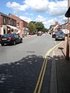
Chirk town centre - Geograph - 544456.jpgB5605 - Geograph - 590218.jpgRuabon Rd, Wrexham - Geograph - 2901188.jpgBangor-on-Dee bypass bridge - Geograph - 629672.jpgB5097 looking towards Ruabon - Geograph - 1595761.jpg
Other nearby roads
Wrexham
A483 • A525 • A528 • A534 • A540 • A541 • A5152 (Wrexham) • A5156 • B5097 • B5098 • B5099 • B5100 • B5101 • B5102 • B5130 • B5425 • B5430 • B5433 • B5445 • B5446 • B5605 • T18 (Britain)
Welsh Tourist Routes
The Wales WayThe Coastal Way / Ffordd Arfordirol • The Cambrian Way / Ffordd Cambria • The North Wales Way / Ffordd Gogledd Cymru
ToursFlintshire Leisure Tour • 'Maelor Tour'
OtherGreat Orme Head Marine Drive • Holyhead Road Historic Route


SABRE - The Society for All British and Irish Road Enthusiasts
Discuss - Digest - Discover - Help