B66 (Northern Ireland)
| B66 | ||||||||||||||||
| Location Map ( geo) | ||||||||||||||||
| ||||||||||||||||
| From: | Bushmills (C939408) | |||||||||||||||
| To: | Limavady (C699233) | |||||||||||||||
| Via: | Dervock, Ballymoney, Agivey, Ringsend | |||||||||||||||
| Distance: | 28.9 miles (46.5 km) | |||||||||||||||
| Meets: | A2, B17, B67, B86, A26, B62, A54, B207, B188, A29, B186, B70, A37 | |||||||||||||||
| Highway Authorities | ||||||||||||||||
| Traditional Counties | ||||||||||||||||
| Route outline (key) | ||||||||||||||||
| ||||||||||||||||
The B66 is an L-shaped B-road in north Northern Ireland.
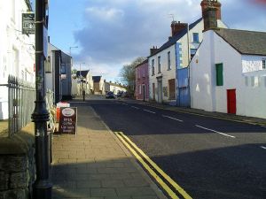
The road starts at a roundabout on the A2 in the centre of Bushmills and heads south along Main Street. It meets the B17 coming in from the right almost immediately to begin a short multiplex, with the B66 presumably dominant although signs are unclear.
The multiplex ends on the southern edge of town and the B66 continues south. It is crossed by the B67 in Derrykeighan before reaching a T-junction in Dervock by the Dervock River. The road TOTSOs right here and follows the river downstream for a mile or so. The river (by now called the Bush River) is crossed and the B66 continues south along Knock Road to reach the A26 Ballymoney bypass. This is crossed at a staggered crossroads and the B66 runs into town to a set of traffic lights where it meets the B62 and starts to multiplex along it along a zigzag route through the town centre.
The B66 regains its number on the southern edge of town, where the B62 TOTSOs left, and then runs west across the fields to cross the Lower Bann to reach Agivey and a T-junction on the A54. There is a multiplex south for two-thirds of a mile until the A54 TOTSOs left and the B66 continues ahead. After running west for a mile or so it reaches a T-junction where it TOTSOs right and then TOTSOs left soon afterwards to continue its westward journey; the "main" road here is the B207.
After going through Aghadowey the A29 is met. There is a short multiplex (or long staggered crossroads) here across the Aghadowey River. The next couple of miles of the B66 are quite straight, although the road does detour to bypass Ringsend. It passes through a forest before straightening out once again and ending on the A37 to the east of Limavady.


