Star.pngStar.pngStar grey.pngStar grey.pngStar grey.png

B23 (Northern Ireland)

From Roader's Digest: The SABRE Wiki
Jump to navigation Jump to search
B23
Location Map ( geo)
Cameraicon.png View gallery (5)
From:  Belfast (J334730)
To:  Lisburn (J272639)
Via:  Ballylesson
Distance:  8.8 miles (14.2 km)
Meets:  A1, A55, B205, A49
Old route now:  A1, A55
Primary Destinations
Highway Authorities

DfI Roads

Traditional Counties

Antrim • Down

Route outline (key)
B23 Belfast
B23 Belfast - Malone
(A55) Malone - Clement Wilson Park
B23 Clement Wilson Park - Lisburn
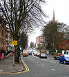
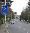
Malone Road, Belfast

The B23 is one of the alternative routes from Belfast to Lisburn.

Originally the B23 started on the B39 North Street and headed along Gresham Street and King Street, along a route that now has the Castle Court shopping centre built on part of it. The route then followed Great Victoria Street (now part of the A1) to its current northern end at Bradbury Place.

The B23 heads south along University Road through the suburbs of Belfast. As might be expected from the street name it passes the Queen's University Belfast before running along Malone Road to meet the A55 at traffic lights. There is then a short multiplex across the River Lagan before the B23 regains its number by turning right. Prior to the inauguration of the A5 there was no gap in the B23 here.

The road then winds through the woods and fields to Ballylesson where it reaches a T-junction. To the left is the B205 (which provides a better route back to Belfast from here) and the B23 TOTSOs right. Our road now heads southwest along a winding road through Hillhall to Lisburn. It goes over the M1 just north of J6 before bending to the left and ending on the A49 (former B6) to the east of the city centre.

The B23 and the B205 is a popular route from the A55 from south-east Belfast to the M1 and Lisburn and this combination of roads acts as something of a ring road to the south of the city. Consequently, the B23 around Hillhall is much busier than most NI B roads.


B23 (Northern Ireland)
Junctions
Places
Related Pictures
View gallery (5)
Malone Road, Belfast - Geograph - 714701.jpgMalone Road, Belfast - Geograph - 661608.jpgBus Lane, Malone Road Belfast - Geograph - 713449.jpg"No U-turns" sign, Belfast - Geograph - 2073297.jpgMercer Street and Gregg Street, Lisburn - Geograph - 990133.jpg
Other nearby roads
Belfast
NCN9 • A1 (Northern Ireland) • A2 (Northern Ireland) • A6 (Northern Ireland) • A11 (Northern Ireland) • A12 (Northern Ireland) • A20 (Northern Ireland) • A23 (Northern Ireland) • A24 (Northern Ireland) • A52 (Northern Ireland) • A55 (Northern Ireland) • A68 (Northern Ireland) • A500 (Northern Ireland) • A501 (Northern Ireland) • A503 (Northern Ireland) • A504 (Northern Ireland) • A510 (Northern Ireland) • B37 (Belfast - Stonyford) • B38 (Northern Ireland) • B39 (Northern Ireland) • B88 (Northern Ireland) • B95 (Northern Ireland) • B102 (Northern Ireland) • B103 (Northern Ireland) • B126 (Northern Ireland) • B170 (Northern Ireland) • B205 (Northern Ireland) • B208 (Northern Ireland) • B500 (Northern Ireland) • B501 (Northern Ireland) • B502 (Northern Ireland) • B503 (Northern Ireland) • B504 (Northern Ireland) • B505 (Northern Ireland) • B506 (Northern Ireland) • Belfast Urban Motorway • C1 (Northern Ireland) • C2 (Northern Ireland) • C265 (Northern Ireland) • C302 (Northern Ireland) • C303 (Northern Ireland) • C369 (Northern Ireland) • C701 (Northern Ireland) • C702 (Northern Ireland) • C703 (Northern Ireland) • C704 (Northern Ireland) • Causeway Coastal Route • E01 • E16 • E18 • E100 • E117 (Old System) • E118 (Old System) • E119 (Old System) • EuroVelo 1 • M1 (Northern Ireland) • M2 (Northern Ireland) • M3 (Northern Ireland) • M4 (Northern Ireland) • M5 (Northern Ireland) • M6 (Northern Ireland) • M7 (Northern Ireland) • M8 (Northern Ireland) • M11 (Northern Ireland) • Mourne Coastal Route • T1 (Northern Ireland) • T2 (Northern Ireland) • T3 (Northern Ireland) • T7 (Northern Ireland) • T11 (Northern Ireland) • T14 (Northern Ireland) • T21 (Northern Ireland)
Lisburn
B1-B99 in Northern Ireland
B1 • B2 • B3 • B4 • B5 • B6 • B7 • B8 • B9 • B10 • B11 • B12 • B13 • B14 • B15 • B16 • B17 • B18 • B19
B20 • B21 • B22 • B23 • B24 • B25 • B26 • B27 • B28 • B29 • B30 • B31 • B32 • B33 • B34 • B35 • B36 • B37 • B38 • B39
B40 • B41 • B42 • B43 • B44 • B45 • B46 • B47 • B48 • B49 • B50 • B51 • B52(W) • B52(E) • B53(W) • B53(E) • B54 • B55 • B56 • B57 • B58 • B59
B60 • B61 • B62 • B63 • B64 • B65 • B66 • B67 • B68 • B69 • B70 • B71 • B72 • B73 • B74 • B75 • B76 • B77 • B78 • B79
B80 • B81 • B82 • B83 • B84 • B85 • B86 • B87 • B88 • B89 • B90 • B91 • B92 • B93 • B94 • B95 • B96 • B97 • B98 • B99
Earlier iterations: B12 • B19 • B37

.

SABRE - The Society for All British and Irish Road Enthusiasts
Discuss - Digest - Discover - Help