Connel
| Connel A' Chonghail | |||
| Location Map ( geo) | |||
 | |||
| |||
| County | |||
| Argyll | |||
| Highway Authority | |||
| Argyll and Bute | |||
| Places related to the Argyll Coastal Route | |||
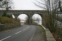
Connel is a small village lying at the mouth of Loch Etive in the West Highlands. Until 1903 it was an important ferry crossing on the road north from Oban to North Lorne and Fort William beyond. However, with the opening of the Connel Bridge, to carry the Ballachulish Branch of the Callander and Oban Railway, the ferrys days were numbered, and it finally ceased when road traffic was (reluctantly, and at a high toll) allowed to cross the bridge (except when a train was crossing). Since the war, the once small settlement of North Connel on the north shore of Loch Etive has grown with a large housing estate to the west and many new houses along the loch shore to the east. The village has long had a small tourist trade, due to the Falls of Lora, a strange phenomena where a rocky shelf under the bridge causes waterfalls and turbulence as the tide changes.
The main road through the village is the A85, which starts in Oban to the south, and runs north, often close to the shore, although it has been slightly realigned at the entrance to the village, Old Shore Road showing the older route of the road. It then follows the shore of Loch Etive as it continues eastwards to Tyndrum and so the central belt. The middle of the village is dominated by the presence of the Connel Bridge, which carries the A828 over the loch, and indeed the A85. The road then curves around to meet the A85 on the shore side towards the south of the village.
On the north bank, the A828 quickly reaches a crossroads, giving access to the east and west parts of North Connel. The old line of the A828 runs through the western part, whilst the road through the eastern part runs up Loch Etive to meet the B845.
Junction
Connel lies at the junction of the A85 and A828, which is situated on the southern shore of Loch Etive. Coming north from Oban, the A828 turns off to the right, while the A85 continues straight on. This can catch unwary drivers out, as the routes do the exact opposite. This confusing situation is caused by the A828 climbing up to cross Loch Etive on the Connel Bridge, with the A85 passing under the bridge on the lochs southern shore. The junction is a simple T junction, and whilst it has been threatened to install traffic signals, the locals have successfully prevented this happening so far - the volume of traffic is rarely sufficient to cause a problem. There is a short right turn lane in the centre of the A85 to accommodate turning traffic, and whilst the split can be fairly even, it is rare for the A85 to become blocked.
In the past, before the Connel Bridge became an untolled road bridge, it was also used by the Ballachulish Branch of the Callander & Oban Railway. At that time, most maps showed the A828 stopping short in North Connel, with the road across the bridge being unclassified, presumably because it was owned by the railway and had a toll. The junction on the south side with the A85 was situated on the north side of the Oyster Inn, only being realigned with a new road built in the 1960s when the Railway closed. This old junction still exists, with the side road now a dead end climbing up towards the bridge. It is a steep climb towards the end, and lines up with the minor road to Kilmore, off of which the bridge road turned, to run alongside the railway over the bridge.
Routes
| Route | To | Notes |
| A' Chrìon Làraich / Crianlarich, (A82) | ||
| An t-Òban / Oban | Argyll Coastal Route | |
| An Gearasdan / Fort William | Argyll Coastal Route, Low Bridge (13'9" / 4.2m) |


