Kilmarnock
| Kilmarnock Cille Mheàrnaig | |||
| Location Map ( geo) | |||
 | |||
| Towards Kilmarnock Town Centre | |||
| |||
| County | |||
| Ayrshire | |||
| Highway Authority | |||
| East Ayrshire | |||
| Forward Destination on | |||
| A71, A76, A77, M77 | |||
| Next Primary Destinations | |||
| Ayr • Dumfries • Edinburgh • Glasgow • Irvine | |||
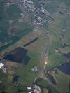
Kilmarnock is a large town in northern Ayrshire, indeed it is one of the largest towns in Scotland and by far the largest in Ayrshire not on the coast. The town prospered through the industrial revolution, with some very fine Victorian buildings in the centre, and still has some large industrial areas spread around the town. In recent years, the growth of Kilmarnock has perhaps stagnated a little, with the Ayrshire coastal belt being the favoured zone for new housing, but it is still a busy town, within easy commuting distance of Glasgow to the north, and indeed the rest of Ayrshire.
The main road past the town is the A77, which follows a dual carriageway bypass to the east. It was re-routed long before the arrival of the M77 just a few miles north of the town, the old route through Kilmarnock now largely being the B7038. Crossing from east to west, the A71 also once ran through the centre, by from Hurlford to the east it now bypasses Kilmarnock to the south. Initially using the former A734 as far as the new Bellfield Interchange, where the A77 and A76 are met, the A71 then follows a new road to the south of the town, and indeed to the south of Irvine as well. The old route into the town centre is now the B7073, and then the B7081 takes over to the west, leading to Irvine.
The A76 once ended on the A71 at Hurlford, but now bypasses to the south west, to reach Bellfield Interchange. The other A road at the junction is the A735, which has been extended south from the town centre to the junction. In the centre, it forms a ring road, whilst to the north, it keeps mostly to its old route to Kilmaurs and on to Stewarton and Dunlop. Also keeping to its old route is the A759, which starts on the A735 in the centre and heads south west crossing the A71, but relying on the B7064 to connect the two routes, and then runs on to Troon.
Kilmarnock is a mass of B roads. In addition to those noted above, the B7082 heads north east from the centre to the A77 bypass, and the B7072 is a short link in the south east of the town. The B7064 has a longer route, forming a half-hearted western ring around the town, whilst the B751 is further out again, and barely even touches the edge of the urban area.
Routes
| Route | To | Notes |
| Glasgow | ||
| Irvine | ||
| Edinburgh | Primary to M74 | |
| Dumfries | ||
| Ayr(A719) | ||
| M77, Glasgow | ||
| Kilmaurs | ||
| Troon | ||
| Riccarton | ||
| Beansburn | ||
| Hurlford | ||
| Crosshouse |
Links


