Rutherglen
| Rutherglen An Ruadh-Ghleann | |||
| Location Map ( geo) | |||
| |||
| County | |||
| Lanarkshire | |||
| Highway Authority | |||
| Glasgow • South Lanarkshire | |||
| Transport Scotland Roads | |||
| M74 | |||
| Places related to the M74 | |||
| Places related to the A724 | |||
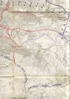
Rutherglen is a town to the south of Glasgow, long since consumed by the suburbs of Scotland's largest city. A Royal Burgh for centuries, industry alongside the Clyde has powered the town for most of that period, with coal mining also important. The centre of the town lies on the south bank of the River Clyde, albeit with a band of industry along the river bank. As Glasgow grew, so the towns beyond Rutherglen also got consumed, making it very difficult today to define the boundaries of where Rutherglen ends and its neighbour begins.
The most important route in Rutherglen is the new section of the M74, which has been built through the industrial belt between the river and town centre. Only Junction 2 really serves the town, meeting the A724 to the east of the centre. This route runs from Glasgow city centre south east to Hamilton. The A730 and A749 also start in the city centre, and pass through the town, before meeting and the A749 heading south to East Kilbride.
The B768 also passes through the town centre, and curves around the south side of the city, almost reaching the Clyde on the west side of Glasgow. Further south, the B762 curves around the south of Rutherglen, with a brief multiplex with the A730, and also continues a long way west.
Routes
| Route | To | Notes |
| Glasgow Airport, Kilmarnock (M8) | ||
| Cambuslang, Carlisle | ||
| Cambuslang, Hamilton | ||
| Stirling (A80), Bridgeton, Dalmarnock | ||
| City Centre, Gorbals | ||
| City centre, Dalmarnock, Parkhead | ||
| East Kilbride | ||
| Carmunnock | ||
| Cambuslang | ||

