Star.pngStar.pngStar grey.pngStar grey.pngStar grey.png

Whithorn

From Roader's Digest: The SABRE Wiki
Jump to navigation Jump to search
Whithorn
Location Map ( geo)
Cameraicon.png View gallery (2)
County
Wigtownshire

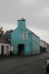
Whithorn is little more than a village towards the southern end of the Machars Peninsula in Galloway. It is a pretty place, essentially just a long single street with rows of often brightly coloured houses along the A746. It also gives its name to the Isle of Whithorn, approximately 4 miles to the south east on the coast, which was home to one of the earliest Christian sites on the Scottish Mainland. Today both Whithorn and the smaller village of Isle of Whithorn still play host to many tourists exploring this part of Galloway.

The main road through Whithorn is the A746, a route which starts near Wigtown to the north and comes to an end a couple of miles to the south west. The B7004 and B7021 lead away to the north and west respectively, with the B7004 also continuing south east along the former A750 route to Isle of Whithorn. As with many of the A roads in the Galloway area, the A750 was downgraded many years ago to be a B road. A similar fate befell the eastern end of the A747, which now terminates end on with the A746. It previously continued east to meet the A750, but this section is now unclassified. There is one more B road serving Isle of Whithorn, the B7063, which runs north towards Garlieston, meeting the B7004 at both ends.

Routes

Route To Notes

A746

Wigtown

A747

Monreith, Port William

B7004

Garlieston

B7021

Port William

B7063

Garlieston


Whithorn
Roads
Related Pictures
View gallery (2)
A746-b7004-whithorn.jpgA746-whithorn.jpg
Places in Scotland
Major CitiesAberdeen • Dundee • Edinburgh • Glasgow • Inverness • Perth • Stirling
Primary DestinationsArbroath • Ayr • Braemar • Campbeltown • Coldstream • Crianlarich • Dumfries • East Kilbride • Elgin • Erskine Bridge • Forfar • Forth Road Bridge • Fort William • Fraserburgh • Galashiels • Greenock • Hawick • Irvine • Jedburgh • Kilmarnock • Kincardine Bridge • Kirkcaldy • Kyle of Lochalsh • Mallaig • Montrose • Newtonmore • Oban • Paisley • Peebles • Peterhead • St Andrews • Stranraer • Tay Bridge • Thurso • Uig • Ullapool • Wick
Other PlacesAberchirder • Aberdeen Airport • Aberfeldy • Aberfoyle • Abington • Airdrie • Alford • Alloa • Alness • Annan • An Tairbeart • Applecross • Ardrossan • Arrochar • Aviemore • Bàgh a' Chaisteil • Ballater • Banchory • Banff • Bathgate • Bowmore • Brechin • Brodick • Buckie • Callander • Castle Douglas • Clydebank • Coatbridge • Comrie • Connel • Coupar Angus • Craigellachie • Craignure • Cromarty • Cumbernauld • Cumnock • Cupar • Dalbeattie • Dalkeith • Dingwall • Dornoch • Dufftown • Dumbarton • Dunbar • Dunblane • Dunfermline • Dunoon • Duns • Durness • Edinburgh Airport • Falkirk • Forres • Girvan • Glasgow Airport • Glenluce • Glenrothes • Gourock • Grantown on Spey • Gretna • Haddington • Hamilton • Helensburgh • Huntly • Inverkip • Inveraray • Inverurie • John o' Groats • Keith • Kelso • Kinlochewe • Kinross • Kirkcudbright • Kirkintilloch • Kirkwall • Kirriemuir • Lairg • Lanark • Largs • Leith • Lerwick • Linlithgow • Livingston • Loch Baghasdail • Loch nam Madadh • Lochgilphead • Lochinver • Lockerbie • Moffat • Motherwell • Nairn • New Galloway • Newton Stewart • Pitlochry • Port Askaig • Port Ellen • Port Glasgow • Portpatrick • Portree • Prestwick Airport • Renfrew • Rosyth • Rothesay • Rutherglen • Selkirk • Stonehaven • Stornoway • Stromness • Tain • Tobermory • Tongue • Wemyss Bay • Whithorn • Wigtown

SABRE - The Society for All British and Irish Road Enthusiasts
Discuss - Digest - Discover - Help