A828
| A828 | ||||||||||
| Location Map ( geo) | ||||||||||
| ||||||||||
| From: | Ballachulish (NN056592) | |||||||||
| To: | Connel (NM908342) | |||||||||
| Distance: | 26 miles (41.8 km) | |||||||||
| Meets: | A82, B845, A85 | |||||||||
| Old route now: | A82 | |||||||||
| Highway Authorities | ||||||||||
| Traditional Counties | ||||||||||
| Route outline (key) | ||||||||||
| ||||||||||
Introduction
The A828 is an important link between Fort William and Oban on the west coast of Scotland, even if it doesn't actually reach either town. It runs from the Ballachulish Roundabout on the A82 in the north, to Connel on the A85 in the south, and is characterized by long fast straights with stunning lochside views, interrupted by older and more winding sections.
Due to the nature of the terrain, there are three significant lochs that need to be spanned, the first is Loch Leven, crossed by the A82, the second is Loch Creran, crossed by the Creagan Bridge, and the third Loch Etive, crossed by the iconic Connel Bridge. Uniquely this means that the A828 passes under the A82 at its northern end, and over the A85 at the southern!
The height limit for the Connel Bridge's superstructure is advertised on the A85 and the A82, in the latter case 24 miles from the actual restriction.
Route
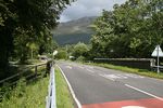
The modern route of the A828 is a stunning drive through some magnificent scenery, with the shore never far away. Long straights, fast bends and then tight sections through the villages of Duror, Appin and Benderloch, the A828 has a bit of everything for a memorable drive.
History
Since the closure of the Connel - Ballachulish Railway line, much of the A828 has been upgraded, often by utilising the old trackbed. In the last 3 years, further work has seen the remnants of the railway line, and old road converted into a new cycle route although work is still ongoing.
The Bridges
Creagan Bridge
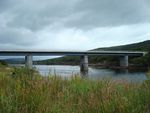
The Creagan Bridge, like the Connel Bridge, was originally designed for a railway line. However, in 1999 the deck was replaced with a modern structure to carry a two-way road, and so eliminate the 6-mile detour around the head of Loch Creran.
Connel Bridge
The iconic Connel Bridge carries the A828 across the narrows at the mouth of Loch Etive. Originally designed for trains, the bridge now has to cope with 21st Century traffic, but despite everything it still stands firm! Due to the bridge's superstructure, there is a height limit of 4.2m/13'9"
Videos
Ballachulish Ferry (1926)
Prior to building of the bridge the ferry was the only way to cross Loch Leven. This scene shows the ferry going from North to South rather than south to north (the direction of the journey), presumably to show a view of the hotel in the distance. This extract comes from Claude Friese-Greene's 'The Open Road' - originally filmed in 1925/6 and now re-edited and digitally resto This extract comes from Claude Friese-Greene's 'The Open Road' - originally filmed in 1925/6 and now re-edited and digitally resto This extract comes from Claude Friese-Greene's 'The Open Road' - originally filmed in 1925/6 and now re-edited and digitally restored by the BFI National Archive. Britain seen in colour for the first time was heralded as a great technical advance for the cinema audience - now we can view a much improved image, but one which still stays true to the principles of the colour process.
|
This page was a candidate for Article of the Month September 2009 | ||


