B3097
| B3097 | ||||
| Location Map ( geo) | ||||
| ||||
| From: | Westbury (ST871513) | |||
| To: | Yarnbrook (ST868549) | |||
| Via: | Hawkeridge | |||
| Distance: | 3.2 miles (5.1 km) | |||
| Meets: | A350, A350, A363 | |||
| Primary Destinations | ||||
| Highway Authorities | ||||
| Traditional Counties | ||||
| Route outline (key) | ||||
| ||||
For the former B3097 in Frome, Somerset, see B3097 (Frome).
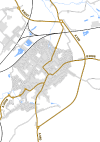
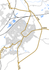
The B3097 follows an alternative route to the A350 north of the Wiltshire town of Westbury. It was unclassified for many years but gained its number around 2000.
The road starts at a mini-roundabout on the A350 on the edge of the town centre and heads northwestwards along the residential Station Road. We cross a double mini-roundabout and then a full-size one, all giving access to housing. After going under a bridge carrying a railway line avoiding Westbury station we pass a lake on the left, after which there's another mini-roundabout providing access to the station.
After crossing the other railway line immediately northeast of Westbury station we turn right at a mini-roundabout to pass through a final suburb before a left-hand bend takes us into open country. We pass an industrial estate before skirting the village of Hawkeridge and reaching a roundabout. Here the road splits. Left takes us to the A363 on the edge of North Bradley, whilst right takes us under the railway line into Yarnbrook, where we meet the A350 and A363 once more.
History
Prior to taking its current route, the B3097 in Westbury consisted just of Edward Street in the town centre, running from the B3098 to the A350. This is first identified in the 1960s, and still shown 20 years later. However, whilst is seems a fairly simple link to connect these two simultaneously with a short multiplex on the A350, so far no mapping evidence to support this has been found.


