C109 (Newcastle upon Tyne)
Jump to navigation
Jump to search
| C109 | ||||
| Location Map ( geo) | ||||
 | ||||
| Trevelyan Drive | ||||
| ||||
| From: | Blakelaw (NZ213674) | |||
| To: | Westerhope (NZ197675) | |||
| Distance: | 1.1 miles (1.8 km) | |||
| Meets: | A167, A191, C107 | |||
| Highway Authorities | ||||
| Traditional Counties | ||||
| Route outline (key) | ||||
| ||||
This article is about the Class III road numbered C109 maintained by Newcastle upon Tyne Council.
For other roads numbered C109, see C109.
For other roads numbered C109, see C109.
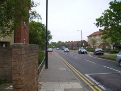
The C109 is a short, urban route in the north west of Newcastle upon Tyne. It begins at a roundabout on the A167 Ponteland Road, just south of Kenton Bar. It sets off west from here as Etal Lane, and shortly afterwards crosses over the A1 without a junction. It continues through a roundabout and past a police station before curving round to the right and giving way at a T-junction on Trevelyan Drive. The C109 turns left here and continues along Trevelyan Drive until it ends on the C107 Newbiggin Lane.
| C109 (Newcastle upon Tyne) | ||||||||||||
| ||||||||||||
|
