C523 (Sunderland)
| C523 | ||||
| Location Map ( geo) | ||||
 | ||||
| Low Moorsley | ||||
| ||||
| From: | Hetton-le-Hole (NZ352474) | |||
| To: | Council Boundary (Durham) (NZ326451) | |||
| Distance: | 2.3 miles (3.7 km) | |||
| Meets: | A182, B1284, C13 | |||
| Highway Authorities | ||||
| Traditional Counties | ||||
| Route outline (key) | ||||
| ||||
For other roads numbered C523, see C523.
The C523 is a short route in the vicinity of Hetton-le-Hole, to the south-west of Sunderland. It begins in the centre of Hetton on the A182 at a light-controlled T-junction, then quickly passes the entrance to the town's bus station and the Eppleton CW football ground, used for Sunderland AFC's reserve team matches. Bending left it runs along The Quay (across a small watercourse known as Hetton Burn) and crosses the B1284 at a staggered junction.
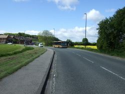
Immediately after the junction, the road - now known as Moorsley Road - climbs steeply as it passes the grounds of Hetton School and crosses a disused railway line. Hetton runs seamlessly into Low Moorsley as the C523 skirts the edge of the settlement, with houses on one side and open fields on the other. The road climbs further towards High Moorsley, affording spectacular views to the north and west for traffic travelling towards Hetton. Eventually the summit is reached and the descent is just as steep, but now entirely rural. After twisting its way down the hill, the road reaches the local authority boundary just to the north of the village of Pittington.
| C523 (Sunderland) | ||||||||||||
| ||||||||||||
|


