C507 (Sunderland)
| C507 | ||||||||||
| Location Map ( geo) | ||||||||||
 | ||||||||||
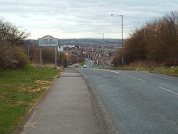
| Hylton Lane at the city boundary | ||||||||||
| ||||||||||
| From: | Castletown (NZ357578) | |||||||||
| To: | Downhill (NZ353600) | |||||||||
| Distance: | 1.3 miles (2.1 km) | |||||||||
| Meets: | A1231, C508 | |||||||||
| Highway Authorities | ||||||||||
| Traditional Counties | ||||||||||
| Route outline (key) | ||||||||||
| ||||||||||
For other roads numbered C507, see C507.
The C507 is a short route in Sunderland, running north-south through residential areas in the north-west of the city. It begins at a roundabout on the A1231 Wessington Way and runs north into Castletown along Baron's Quay Road. Passing over a mini-roundabout, it becomes Hylton Castle Road before leaving the houses behind to cross over Hylton Dene. Climbing out of the valley, it passes the castle itself before arriving at a set of traffic lights on the C508 Washington Road.
After a short multiplex west along Washington Road, the C507 resumes by turning right at the next set of lights onto Hylton Lane and the road regains its suburban character. Climbing steeply, the road passes Bunny Hill medical centre before levelling out, soon leaving the built-up area. Hylton Lane continues north to West Boldon, but the local authority boundary is reached long before then and with it the end of the C507.
| C507 (Sunderland) | ||||||||||||
| ||||||||||||
|
