A471
| A471 | ||||
| Location Map ( geo) | ||||
| ||||
| From: | Abergavenny (SO299141) | |||
| To: | Usk (SO376009) | |||
| Distance: | 11 miles (17.7 km) | |||
| Met (1934): | A40, A4125, B4234, A48 | |||
| Now part of: | A40, B4598 | |||
| Traditional Counties | ||||
| Route outline (key) | ||||
| ||||
The A471 was a rural A-road in Monmouthshire.
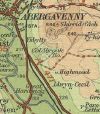
Starting on the A40 in Abergavenny town centre, the road left town along Monmouth Road. The road continued southeastwards, roughly following the River Usk downstream.
At Llanvihangel Gobion the road met the B4234 which continued ahead in towards Monmouth and turned right, continuing to follow the river, which was crossed for the first time just after the village. The road continued downstream, crossing the river again a couple of miles later before running adjacent for the last mile or so into the town of Usk. The road ended on the original line of the A48 in the centre of town.
In 1935 the A471 lost half its route. The A40 was rerouted via Monmouth and so took on the whole of the A471 between Abergavenny and Llanvihangel Gobion. The remainder of the route survived until at least the 1970s. However, when the A40 was upgraded in this area no junction was built to serve the A471 and so the raison d'être of the road was removed. The road became the B4598, which also took over that part of the bypassed A40 which used to be the A471 as far as Abergavenny itself. The final section of the ex-A471 in the town is still part of the A40.


