A448
| A448 | ||||||||||
| Location Map ( geo) | ||||||||||
| ||||||||||
| From: | Kidderminster (SO835764) | |||||||||
| To: | Studley (SP076623) | |||||||||
| Via: | Bromsgrove | |||||||||
| Distance: | 19.6 miles (31.5 km) | |||||||||
| Meets: | A451, A449, A450, B4091, B4184, A38, B4096, B4504, A441, A4189, B4504, B4092, A435 | |||||||||
| Former Number(s): | A491 | |||||||||
| Old route now: | B4184 | |||||||||
| Primary Destinations | ||||||||||
| Highway Authorities | ||||||||||
| Traditional Counties | ||||||||||
| Route outline (key) | ||||||||||
| ||||||||||
The A448 is a primary road running between the Worcestershire towns of Kidderminster and Redditch, before heading across the Warwickshire border to meet the A46.
Route
Section 1: Kidderminster – Bromsgrove
The road starts on the A451 Kidderminster Ring Road, and heads uphill to the east, passing Kidderminster stations (first for the Severn Valley Railway and then for National Rail services just afterwards). Shortly past this the A449 is met at a traffic-light-controlled crossroads. On its way out of the town, the A448 passes near the suburbs of Comberton and Spennels. A roundabout marks the edge of Kidderminster and we head out into the country, passing the village of Stone before crossing the A450 at a roundabout in Mustow Green.
Staying rural in nature the A448 twists through the North Worcestershire countryside, now passing the villages of Chaddersley Corbett and Dodford, before passing under the M5 just to the west of Bromsgrove. The layout of the town means that it's not far to travel into the Town Centre, where we meet the B4091 (former A38) which multiplexes with us around the Town Centre. We TOTSO at a set of traffic lights, initially heading back on ourselves before turning to head East out of the town, eventually meeting the A38 at a roundabout on the Eastern bypass.
Section 2: Bromsgrove – Studley
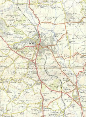
The A448 becomes dual carriageway beyond the A38, named the Bromsgrove Highway, it bypasses the villages of Finstall and Tardebigge, with the old route running alongside. The first junction is just after we enter Redditch, a modified trumpet junction with the B4184 (the old route). Our next junction is a diamond with the B4504 (which is unsigned here) for Headless Cross (this road rejoins the A448 and A441 at Crabbs Cross roundabout on the other side of town). The following junction with the A441 and A4189 is a cloverleaf junction, the only one in England, named as such because of how it looks from above. The A448 route turns off here (turning 270 degrees in this direction) to multiplex with the A441 to the south for about a mile.
We resume at a roundabout on the edge of Redditch, as a single carriageway road, immediately entering Warwickshire. Unusually one of the route confirmation signs here gives the distance to Oxford. The road is fairly straight as it approaches Studley, and then passes to the West of the town. Eventually the A448 terminates on the A435 to the south of the town.
History
Bromsgrove - Redditch
Before the Bromsgrove - Redditch dual carriageway was built, the old route from Bromsgrove followed (west - east) High Street - New Road - Finstall Road - Alcester Road - Hewell Lane. Parts of Alcester Road were built over by the new dual carriageway, so not all of this is on its original line. This is all now the B4184. The current route of the A448 after the A38 multiplex along the High Street) was the original eastern end of the A449 (renumbered A491 in 1935).
The 4 mile dual carriageway from Slideslow, Bromsgrove (just east of current Slideshow Island) to Birchfield Road, Webheath was opened "last month" per the 27 May 1975 Birmingham Evening Mail. It bypassed Finstall and Tardebigge. Cost was £1.5 million.
Redditch town centre
The A448 never used to run so close to Redditch town centre; it was realigned onto newer dual carriageway roads only when Redditch was designated a new town in the 1960s, the old route following (from west to east) Birchfield Road and Evesham Road (multiplex with the A441, which was joined at Headless Cross).


