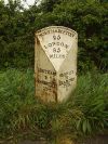
A425
| A425 | ||||||||||||||||||||||
| Location Map ( geo) | ||||||||||||||||||||||
| ||||||||||||||||||||||
| From: | Warwick (SP267658) | |||||||||||||||||||||
| To: | Daventry (SP570645) | |||||||||||||||||||||
| Via: | Leamington Spa, Southam | |||||||||||||||||||||
| Distance: | 25.1 miles (40.4 km) | |||||||||||||||||||||
| Meets: | A46, A4177, A429, A452, B4087, B4099, B4455, B4452, B4451, A423, A45, B4038, B4036, A4256, A361 | |||||||||||||||||||||
| Former Number(s): | A41 | |||||||||||||||||||||
| Primary Destinations | ||||||||||||||||||||||
| Highway Authorities | ||||||||||||||||||||||
| Traditional Counties | ||||||||||||||||||||||
| Route outline (key) | ||||||||||||||||||||||
| ||||||||||||||||||||||
The A425 in Warwickshire and Northamptonshire links the A46 at Warwick to the A45 and A361 at Daventry.
Route
The initial section of the road, starting at a grade-separated junction with the A46 Warwick Bypass, close to Warwick Parkway railway station west of the town, follows what was formerly a section of the A41 running southeastward into and through the town centre, then crossing the River Avon by a stone bridge from which there is a good view of Warwick Castle to the right.
From the roundabout at the southern end of the bridge the A425 continues southeastward for nearly 3 km more of the old A41 – but this amounts, in fact, to no more than a long spur, terminating at a junction with the A452 giving connections to Junctions 13 and 14 of the M40, for if we return to that roundabout on the south side of the Avon in Warwick we find ourselves at the A425's original 1922 starting-point, and from here the main part of today's route continues to run east towards Leamington Spa and beyond.
After meeting another branch of the A452 at a roundabout in the southern part of the town we pass by Leamington railway station on our left, go along the old town's short High Street (which is, however, far from being Leamington's grandest thoroughfare today!), then beneath the railway line. As we leave Leamington we come alongside the course of the River Leam, which gave the district its name (Lamintone in Domesday Book).
We then pass the village of Radford Semele before reaching a roundabout with the B4455. To our right we have Fosse Farm, and to our left we have North Fosse Farm, for the B4455 follows the line of the old Roman Fosse Way, itself a good drive. We carry on through the small village of Ufton, before reaching a staggered crossroads, the right turn being the B4452 towards the M40 (Junction 12) and the left being a minor road to Long Itchington, which cuts off the corner with the A423.
Another couple of miles on the A425 brings us to a roundabout on the outskirts of Southam, giving access to an industrial estate, then soon after we reach another roundabout on the A423 Southam bypass. The original A425 turned off to run through the town just prior to the industrial estate roundabout, but we now join the southern leg of the A423 bypass to avoid the town centre. Both routes multiplexed along that road.
At the next roundabout we turn right, back on the A425, and run across a flat expanse of countryside, crossing the Oxford Canal at the foot of Napton Hill, just north of the village of Napton-on-the-Hill. We avoid the bulk of the hill, preferring instead to run alongside the canal to Lower Shuckburgh, where at last we have to begin climbing slightly up Park Hill. The road continues across a patchwork of fields, fairly straight for much of the way, until we pass through Staverton, where we bear left at a roundabout towards Daventry and a roundabout on the A45. The original route of the A425 continued ahead along what is now the A45 but we now turn right to multiplex (with the A45 and A361) around the south of the town. The A361 soon leaves the multiplex by turning right at a single-carriageway trumpet junction. At the next roundabout, we go straight ahead whereas the A45 turns right.
We now form the eastern bypass of Daventry (known as South Way), becoming Northern Way after we cross Eastern Way. Northern Way runs past the Daventry Reservoir, then bears left at a roundabout to meet the A361 once again at a roundabout where the A425 terminates.
Opening Dates
| Year | Section | Notes |
|---|---|---|
| 1990 | Staverton Bypass | 0.4 mile road from the Daventry Road to Park Hill / Badby Road. Opened on 15 March 1990 per the Land Compensation Act notice. Daventry and District Weekly News reported on 5 April 1990 that it had been opened "last week" by Gina Ogden, Chairman of Northamptonshire Education Committee. Cost £1.1 million. |
| 1992 | Southam Bypass | Opened on 3 July 1992 by Fred Watson, County Councillor. Contractor was Midland Oak, tender cost £2.2 million. Part was A423. |
| 1994 | Daventry: Northern Way | Opened on 12 August 1994 per the Land Compensation Act notice. |


