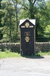
A479 (Crickhowell - Llyswen)
| A479 | |||||||
| Location Map ( geo) | |||||||
| |||||||
| From: | Crickhowell (NW) (SO196199) | ||||||
| To: | Llyswen (SO131380) | ||||||
| Via: | Talgarth | ||||||
| Distance: | 22.1 miles (35.6 km) | ||||||
| Meets: | A40, B4560, A4078, A438, A4079, A470 | ||||||
| Old route now: | A470 | ||||||
| Highway Authorities | |||||||
North & Mid Wales TRA | |||||||
| Traditional Counties | |||||||
| Route outline (key) | |||||||
| |||||||
For the road near Wembley Stadium, see A479 (Wembley).
Route
If you head north west from Crickhowell for a mile and a half along the A40, you reach a fork in the road. If you stay on the A40 you will get to Brecon. If you take the right hand fork you join the A479 which, once upon a time, would have taken you to Builth Wells and beyond. These days the latter part of the route has become part of the A470, but the A479 still carves out a route between here and, well, nowhere in particular, as we shall see.
Crickhowell - Bronllys
We start our trek by passing through Tretower, which gives protection to the steeply sided valley. At this stage, the A40 can be seen running on the opposite side of the broad valley floor - and there are a couple of minor roads connecting the two - but soon the valley splits in two (or should that be two valleys join?) and the A40 heads west through one as we head north through the other to Cwmdu (Black Valley). As the valley gets narrower, the road starts to climb more steeply. We cross the river (Rhiangoll) several times, and a series of minor roads lead to remote mountain farms.
We reach a height of nearly 900 ft, with the surrounding hills reaching 2000 ft, then at Pengenffordd, the steep slopes give way to a more gentle but still hilly landscape as we drop down towards Talgarth. A right turn onto the A4078 will cut off the corner with the A438 towards Hereford, but we continue past Bronllys castle to the Bronllys bypass where we turn right at a roundabout junction with the A438's final westbound section and become the dominant partner in a multiplex. Less than half a mile later we turn left – where the A438 resumes its England-bound run – and descend towards the River Wye. First of all we reach a right turn with the A4079, which performs the same function for traffic from the north towards the A438 as the A4078 does for traffic from the south. Then we reach Llyswen, a very small village on the banks of the Wye. We pass a T junction on the left hand side where the A470 joins our route, and suddenly, though we have right of way, we are no longer on the A479 but on the A470.
That's it for the A479. Here, almost in the middle of nowhere, an imposter has taken over the A479, as it has done with a number of other Welsh A-roads, in order to create a single route number linking north and south Wales - the A470: one of Britain's longest 3-digit A-roads, but only because it has taken big chunks of other routes. The A479 originally ended on the A44 at Rhayader but all of this is now A470.


