A451
| A451 | ||||||||||
| Location Map ( geo) | ||||||||||
| ||||||||||
| From: | Stourbridge (SO900840) | |||||||||
| To: | Great Witley (SO752661) | |||||||||
| Via: | Kidderminster | |||||||||
| Distance: | 16.2 miles (26.1 km) | |||||||||
| Meets: | A491, B4186, B4189, A449, A456, A448, A442, A4535, B4549, A4420, B4195, A4025, B4196, B4194, B4197, A443 | |||||||||
| Primary Destinations | ||||||||||
| Highway Authorities | ||||||||||
| Traditional Counties | ||||||||||
| Route outline (key) | ||||||||||
| ||||||||||
The A451 is a Non-Primary Route in north Worcestershire.
The road begins on the Southern leg of the Stourbridge A491 one-way system, New Road. To get on the A451 you take a left turn into Worcester Street, and head due South to a roundabout on the B4186 outside Mary Stevens Park, given to the people of Stourbridge by her husband in 1929. We turn right, multiplexing with the B road for a short distance before turning left into Norton Road at a mini roundabout. We head South West out of the town along a very straight alignment, the houses giving way to fields on the left hand side and woods on the right and cross a corner of Staffordshire, spending less than a mile in that county.
After passing an old hospital site, we reach a junction with the B4189 to the right, then shortly after we converge with the A449 at a mini-roundabout on the way into Kidderminster. After crossing a stream, the A449 takes the Easternmost A road through the town at another mini-roundabout adjacent to The Rose Theatre, whereas the A451 ploughs on towards the middle, via Stourbridge Road.
In 2020, an effort to reduce the congestion in Horsefair and Blackwell Street resulted in a new one-way scheme which saw the building of two new short sections of road incorporating the northbound A451 (the southbound A451 now continuing as a one-way street along Blackwell Street to the A456 Ringway roundabout). In the new layout, traffic on the Ringway is now sent along a new unnamed road leading from the roundabout just to the west of Blackwell Street meeting the existing Churchfields road at a modified filtered T-junction. The northbound A451 now runs along Churchfields meeting the old A451 at Horsefair where the new layout finishes. In addition to this, a second new road has been built from the A456 St Mary's Ringway connecting to St Mary's Street (incorrectly labelled as Clensmore Street on Google Maps!). This also facilitates access to Churchfields and so provides an alternative to having to use the roundabout if it was busy. At the time of writing this (March 2021) it is not clear which roads if any are actually the A451 although it is likely to be the new road from the roundabout followed by Churchfields. The new signage is contradictory - although one new sign on St Mary's Ringway states it is the A451, others suggest not and none of the current mapping I've seen clarifies it yet.
We meet the ring road at a roundabout, and turn left (east) to multiplex with the A456 as far as the next roundabout. The next sections of the Ring (Worcester Cross Ringway and Constitution Hill Ringway) are also the A451 (the only primary section of this road), then we cross the River Stour and meet the Worcester Road Island, which marks the Southernmost point of the ring road (and is so big there's a bus depot in the middle, together with dedicated entrance/exit lanes). We continue along Stourport Road, past the A4535, then, as we leave the built up area, the A451 becomes dual carriageway, at least until we pass an athletics track on the way into Stourport-on-Severn.
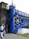
After passing a pair of speed cameras, we negotiate the town centre gyratory system (some of which may be the A4025), crossing the canal a couple of times before we cross the Severn itself on Stourport Bridge. We head South-West out of the town, back into farm land, then passing into hillier country as we skirt the Southern flank of the wooded Abberley Hill on our way to the terminus of the A451 on the A443 on the edge of Great Witley.
Videos
Driving round Stourbridge Ring Road when it first opened
This is the final section of the video footage from 1969, driving round the ring road when it first opened. some parts look much the same as they do today but it is interesting to see some of the old buildings that have long gone, and the cars!


