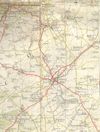
A434
| A434 | ||||||||||
| Location Map ( geo) | ||||||||||
| ||||||||||
| From: | Malmesbury (ST932872) | |||||||||
| To: | Hardwicke (SO800119) | |||||||||
| Via: | Stroud | |||||||||
| Distance: | 21.4 miles (34.4 km) | |||||||||
| Met: | A429, A433, A46, A4020, A4096, A38 | |||||||||
| Now part of: | B4104, A46, B4008 | |||||||||
| Traditional Counties | ||||||||||
| Route outline (key) | ||||||||||
| ||||||||||
The A434 is described in the 1922 Road Lists as Malmesbury - Tetbury - Nailsworth - Stonehouse - Hardwicke.
Starting on the A429 in the centre of Malmesbury, the road left town up Tetbury Hill before crossing the Fosse Way and reaching Tetbury itself. The A433 zigzagged to cross it in the town centre before the A434 continued northwards via Avening where there was a severe left bend before a winding section of road led to the A46 at Nailsworth.
A multiplex of about 3 miles led to Lightpill, now part of the Stroud urban area, where the A434 regained its number bearing left to cross the River Frome at Dudsbridge. It now headed west alongside the river before bearing right into Stonehouse. The road continued in a vaguely northerly direction to Hardwicke, where it met the A38.
In 1935, the A419 was extended from Cirencester via Stroud to Hardwicke, taking over most of the northern section of the A434. This has now been bypassed and the A419 rerouted to meet the M5, so this is now numbered B4008. The short section from Lightpill to Cainscross became a spur of the A46 which it remains.
The southern half of the A434 was not affected by the 1935 renumberings. It remained until at least the 1970s but has since been downgraded as well, becoming the B4104.
| A434 | ||||
| ||||
| ||||
| ||||
|


