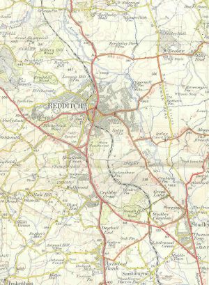
A441
| A441 | ||||||||||
| Location Map ( geo) | ||||||||||
| ||||||||||
| From: | Birmingham (SP070853) | |||||||||
| To: | Cookhill (SP054571) | |||||||||
| Via: | Redditch | |||||||||
| Distance: | 19.9 miles (32 km) | |||||||||
| Meets: | A4540, B4217, A4029, A4040, B4121, B4096, B4120, M42, B4101, B4184, B4160, A4023, A4189, A448, B4504, B4092, B4090, A422 | |||||||||
| Old route now: | B4120, B4088 | |||||||||
| Primary Destinations | ||||||||||
| Highway Authorities | ||||||||||
| Traditional Counties | ||||||||||
| Route outline (key) | ||||||||||
| ||||||||||
Route
The A441 runs south from central Birmingham to Redditch and a terminus on the A442 west of Alcester.
Section 1: Birmingham city centre – Hopwood
The A441 starts on the Birmingham Middleway (A4540) at Belgrave Interchange. The road heads south away from the city centre as a non primary road, through the suburb of Edgbaston. On the right, the A4029 is passed, one of the county's shortest A roads, just linking here to the A38 past Pebble Mill. Continuing South, passing through Selly Park and then Stirchley, where there is a short one-way loop, the A4040 arrives at a T-junction on the left, which road multiplexes with us for a short distance until Cotteridge, where it leaves us again on the right at a roundabout, and we become primary for our final leg out of Birmingham. The B4121 goes off towards Northfield at a second roundabout, while the A441 drops down a hill heading towards West Heath.
For about a mile north of West Heath, we drop down to single carriageway, part of which is wide enough to be dualled. Once we resume dual-carriageway status we only keep it for a short while; after the next roundabout with an unclassified road, the A441 is single again. Another roundabout is passed, taking away the B4096 towards Longbridge, and suddenly we are out of Birmingham.
We pass through the village of Hopwood, where the former A441 (now B4120) heads off into Alvechurch, while we approach the M42 at junction 2, which also provides access to Hopwood Park services. This section of single carriageway road to the north of the M42 was originally built as a spur to the motorway junction which opened in 1986.
Section 2: Hopwood – Cookhill
After the motorway junction, the A441 is dual-carriageway; this was constructed in 1993 as the Alvechurch bypass. At the end of the bypass the road reverts to single-carriageway and we pass through the village of Bordesley, and a junction with the B4101. We meet the B4184 at a roundabout on the edge of Redditch; this has space for an A441 flyover, presumably part of the Bordsley bypass, but hasn't yet happened. Another roundabout is passed, this time with the A4023. Once again, there is space for a flyover to create a 3-level stack, as the A4023 already passes under the roundabout.
Our next major junction is with the A448 and A4184 – this isn't just any old junction, this is a cloverleaf junction, the only one in England. It is so named because of the way it looks from the air. For the next mile the A448 multiplexes with us. We pass another roundabout junction with some unclassified roads and finally on the south side of Redditch we reach a tiny roundabout, with five exits, one of which is where the A448 leaves us, and we head off to the south, passing through the village of Astwood Bank.
The final short section meets the B4092 and B4090 before terminating on the A422 at the Cookhill Priory (staggered) crossroads immediately south of Cookhill village. The road straight ahead, the B4088, was formerly a continuation of the A441 and is still signposted to Evesham.
History
Birmingham city centre
The A441 originally started on the A41 (now B4100) in the Bull Ring and ran along Spiceal Street, Jamaica Row, and Sherlock Street out of the city centre. From the 1960s onwards, with the original northern end built on by the markets, the A441 followed various routes from the A41, roughly parallel to the original alignment.
Alvechurch Bypass
The 2 mile dual carriageway from M42 J2 Hopwood Park Interchange southwards to Cobbs Barn Roundabout on Birmingham Road, Bordesley was opened on 12 November 1993 by John Wardle, Chairman of Hereford and Worcester Council. Cost was £4.8 million. The link road north of M42 had opened in 1986 with the motorway.
Redditch town centre
When Redditch was developed as a new town in the 1960s, the A441 was rebuilt on new alignments, mostly dual-carriageway. The former road still exists as (from north to south) Birmingham Road - Prospect Hill - Church Green West - Evesham Walk - Evesham Street - Mount Pleasant - Evesham Road. The central section of this cannot be driven though – part of it is buses only, part has been cut off by the ringway, and part (Evesham Walk) is within the Kingfisher Shopping Centre!
Cookhill – Dunnington
This section became the B4088 when the A46 Norton and Salford Priors bypass was opened in the 1990s. The section of the A435 through Dunnington, which was where the A441 originally terminated, was also downgraded at the same time.
Future
Bordesley bypass
The final single carriageway between the M42 and Redditch sits between the Alvechurch bypass and Redditch itself. Plans have been on and off for sometime about building this bypass.


