A491
| A491 | |||||||||||||
| Location Map ( geo) | |||||||||||||
| |||||||||||||
| From: | Lydiate Ash (SO968756) | ||||||||||||
| To: | Wall Heath (SO884900) | ||||||||||||
| Via: | Stourbridge | ||||||||||||
| Distance: | 12 miles (19.3 km) | ||||||||||||
| Meets: | M5, A38, B4551, B4091, B4188, A456, B4187, A4036, B4186, A451, A458, A461, A4102, B4180, A4101, B4175, A449 | ||||||||||||
| Former Number(s): | A449 | ||||||||||||
| Old route now: | A448, B4091 | ||||||||||||
| Primary Destinations | |||||||||||||
| Highway Authorities | |||||||||||||
| Traditional Counties | |||||||||||||
| Route outline (key) | |||||||||||||
| |||||||||||||
For the original A491 between Shrewsbury and Cemmaes Road in Mid Wales which is now mostly the A458, see A491 (Shrewsbury - Cemmaes Road).
The A491 is quite different in character from the other members of the A49x group that earn their living by threading their way through the Welsh mountains. This one runs through Worcestershire and the Black Country.
Route
Section 1: Lydiate Ash - Hagley
The A491 starts at junction 4 of the M5, heading west as a single carriageway. The first turning on the right into what looks like a narrow country lane used to be the A459, and yes it is as narrow as it looks. The second turning on the right is the modern B4551; again this used to be the A459 when it was upgraded from the previous narrow road. We meet a roundabout near Fairfield with the B4091; this is the former A491 route to Bromsgrove and beyond.
The road becomes dual after this roundabout, though the first section is now only a single lane with a 50 mph speed limit; this is due to the poor accident record of this section. The locals were in favour of creating two roundabouts at the next junction, but instead two sets of traffic lights were chosen, first with an unclassified road to Romsley, and second with the B4188 to Belbroughton. After this junction the road widens out to two lanes and the limit rises to 60 mph. We pass several side turnings and even pass over a roundabout (though there are no links to it from the A491). This section comes to an end on the A456 at a roundabout in Hagley.
Section 2: Hagley - Wall Heath
After a short multiplex with the A456, the A491 resumes its northward course at traffic lights. It is a dual carriageway, though now the limit is 40 mph, with a couple of speed cameras and gaps in the central reservation. At a roundabout the A4036 leaves us to the right, taking traffic with it to Merry Hill and Dudley. From this point on the A491 is single carriageway again, going through the suburb of Oldswinford and passing Stourbridge College.
It joins the Stourbridge Ring Road on the South end, and resumes again to the North. The ring road also meets the A451 and A458 - and some maps claim different parts of the road to be any of these three numbers. The final leg of the journey passes through Amblecote, Wordsley and Kingswinford, meeting the A461, A4101 and B4175 at traffic-light-controlled junctions. The A491's journey ends at a roundabout on the A449 in Wall Heath.
History

Early History
As may be expected from the road numbering, the original A491 did indeed run in mid-Wales. What is now the A491 started life as the A449 which at the time ran from Finstall, near Bromsgrove, to Newcastle-under-Lyme. The A449 was rerouted to Newport, Monmouthshire in 1935 and its old route south of Wall Heath took on the A491 number, which was vacated at the same time.
Bromsgrove Curtailment
The A491 used to run from the original route of the A448 at Finstall, East of Bromsgrove, through the town and along what is now the B4091 to meet the current route near Fairfield. After construction of the M5 the A491 was rerouted to meet it in the 1960s.
Holy Cross Bypass
Before construction of the current dual carriageway, the A491 wove through the village of Holy Cross on its way towards Stourbridge. The original route follows Bromsgrove Road from just south of the village, passes under the current A491 at a roundabout, and rejoins the current route at the traffic-light-controlled junction of the A491 and A456. The left-turn slip at this junction is the original line of the road.
Stourbridge Town Centre and Ring Road
The A491 originally carved a straight line through the town centre along High Street and Lower High Street. The Ring Road opened in two stages. In 1968 the A491 was re-routed on the eastern side of the Ring Road along St John's Road, which opened for temporary two way running. The Ring Road was completed in 1969 and the A491 was re-routed and ran round the town in a clockwise direction on the one way system. For the Ring Road History and dates see Stourbridge.
Pictures
Section 1: Lydiate Ash - Hagley
Note the direction of travel in this gallery is the opposite direction to that of the write up.
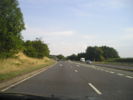
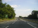
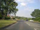
Near the start of the dual carriageway section at Hagley.
Passing over the unconnected roundabout.
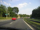
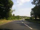
Trees closely line this section.
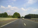
Approaching the 'D1' section.
You can see the former lane markings in this picture.
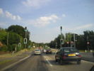
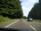
The first set of traffic lights.
Just after the second set.
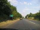
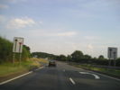
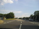
After the B4091 roundabout the road is single carriageway again.
A former alignment can be seen on the left.
The final approach to the M5.
A works depot on the left.


Section 2: Hagley - Wall Heath
Note the direction of travel in this gallery is the opposite direction to that of the write up.
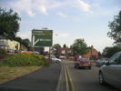
This is the fork for the former A450.

Videos
Driving round Stourbridge Ring Road when it first opened
This is the final section of the video footage from 1969, driving round the ring road when it first opened. some parts look much the same as they do today but it is interesting to see some of the old buildings that have long gone, and the cars!

