A443
| A443 | ||||
| Location Map ( geo) | ||||
| ||||
| From: | Worcester (SO844548) | |||
| To: | Newnham Bridge (SO644691) | |||
| Distance: | 18 miles (29 km) | |||
| Meets: | A44, B4206, B4204, A4133, B4196, B4197, A451, B4203, B4202, A456 | |||
| Primary Destinations | ||||
| Highway Authorities | ||||
| Traditional Counties | ||||
| Route outline (key) | ||||
| ||||
The A443 is a lovely half-an-hour's drive. Quite a lot of speed restrictions but who cares? It's a peaceful road with some beautiful views. Don't be fooled by the signs though: they tell you this road goes to Tenbury. It doesn't – but it has a good try.
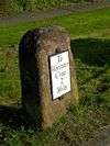
The road starts at the west end of the Worcester Bridge over the Severn on a one-way loop on the A44. We head north on Hylton Road/Henwick Road/Hallow Road alongside the river, passing the B4206 and B4204 (to Martley) on the left. As you leave town you'll see Hallow church spire in the distance. Hallow village has a split personality. The part you drive through first seems very posh indeed, complete with Lexus dealership. But then the character of the village changes and it looks like the kind of place where real country people live. The road continues to follow the Severn until Holt Heath. Here we bear slightly to the left, while the B4196 runs north and the A4133 goes east to cross the Severn at the Holt Fleet Bridge. A little further on, look out on the right for a well-preserved milepost. There are more mileposts which can be spotted on this route.
Next on the journey are the hamlets of Little and Great Witley, with the magnificent ruins of Witley Court between them. On the hilltop ahead is the clock tower at Abberley Hall School. Before we get to the hill the B4197 crosses our path at a staggered junction and the A451 Stourport road comes in from the right at the Hundred House pub. There are two more B-roads, the B4203 (to Bromyard) to the left before the hill (184 m), the B4202 to the right after it.
Skirting Abberley, we head west again, pass The Elms Hotel and head down through the hamlet of Stockton-on-Teme. So now we're in the Teme valley, and you can see signs of hop-growing. On through Eardiston and then there's a slightly hairy moment when we have to bend sharply uphill by Lindridge church to avoid the river below. Not far now; after a sharp right-hander the road suddenly becomes the A456 at the Newnham Bridge TOTSO.


