Star.pngStar.pngStar grey.pngStar grey.pngStar grey.png

A401

From Roader's Digest: The SABRE Wiki
Jump to navigation Jump to search
A401
Location Map ( geo)
Cameraicon.png View gallery (9)
From:  Piccadilly Circus (TQ295806)
To:  Angel (TQ314831)
Distance:  2.2 miles (3.5 km)
Meets:  A4, A4201, A400, B404, A40, A5200, A5201, A201, B502, B501, A1, A501
Primary Destinations
Highway Authorities

Camden • Islington • Westminster

Traditional Counties

Middlesex

Route outline (key)
A401 Piccadilly Circus – Angel

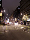
The A401 is a zigzag road in central London.

The route starts in Piccadilly Circus – giant TDK and Sony signs, Tower Records, that sort of thing – and heads along Shaftesbury Avenue crossing the A400 at its Theatre on Cambridge Circus. There's then a complete mixup with the A40 and southbound A400 until it sorts itself out to run on Theobald's Road.

Theobalds Road

The A401 then splits off to the left up Rosebery Avenue past the Royal Mail Centre, crosses Farringdon Road, and TOTSOs at St John's Street with the B501 before terminating at the Inner Ring Road A501 a few hundred yards to the north. The road ahead is the A1 Islington High Street.



A401
Junctions
Places
Related Pictures
View gallery (9)
's Bush Green - Geograph - 1151487.jpgPiccadilly Circus, London W1 - Geograph - 1098016.jpgAngel Islington 1970s proposal.pngAngel Building - Geograph - 2917437.jpgTraffic lights, Cambridge Circus - Geograph - 4417014.jpg
Other nearby roads
Central London
A Ring • A2 • A3 • A4 • A5 • A10 • A11 • A13 • A23 • A40 • A40(M) (Central London) • A41 • A100 • A200 • A201 • A202 • A203 • A215 • A300 • A301 • A302 • A303 (Vauxhall - Wandsworth) • A400 • A402 • A404 • A500 (Marble Arch - Finchley) • A501 • A1200 • A1202 • A1203 • A1204 (Wapping) • A1208 • A1209 • A1210 • A1211 • A1212 • A1213 • A2198 • A2200 • A2205 • A2206 • A2207 • A3036 • A3200 • A3201 • A3202 • A3203 • A3204 • A3205 • A3211 • A3212 • A3213 • A3213 (Pall Mall) • A3214 • A3215 • A3217 • A4200 • A4201 • A4202 • A4203 • A4205 • A4208 • A4209 • A4801 • A5200 • A5201 • A5202 • A5203 • A5204 • B100 • B101 • B107 • B126 • B128 • B129 • B130 • B131 • B132 • B133 • B134 • B139 • B144 • B200 • B201 • B202 • B240 • B300 • B308 • B309 • B310 • B310 (Thames Embankment) • B311 (Westminster) • B312 • B323 • B324 • B326 • B327 • B400 • B401 • B402 • B403 • B404 • B405 (Trafalgar Square) • B406 • B500 • B501 • B502 • B503 • B504 • B505 • B506 • B507 • B513 • B521 • B522 • B523 • B524 • CS1 • CS2 • CS3 • CS5 • CS6 • CS7 • CS8 • E1 (Old System) • E2 (Old System) • E5 (Old System) • Ermine Street • EuroVelo 2 • Great North Road • Holyhead Road • London Inner Ring Road • Longest Lane • M1 • M11 • NCN13 • NCN4 • RM3 • Watling Street
A400-A499
A400 • A401 • A402 • A403 • A404 • A405 • A406 • A407 • A408 • A409 • A410 • A411 • A412 • A413 • A414 • A415 • A416 • A417 • A418 • A419
A420 • A421 • A422 • A423 • A424 • A425 • A426 • A427 • A428 • A429 • A430 • A431 • A432 • A433 • A434 • A435 • A436 • A437 • A438 • A439
A440 • A441 • A442 • A443 • A444 • A445 • A446 • A447 • A448 • A449 • A450 • A451 • A452 • A453 • A454 • A455 • A456 • A457 • A458 • A459
A460 • A461 • A462 • A463 • A464 • A465 • A466 • A467 • A468 • A469 • A470 • A471 • A472 • A473 • A474 • A475 • A476 • A477 • A478 • A479(W) • A479(E)
A480 • A481 • A482 • A483 • A484 • A485 • A486 • A487 • A488 • A489 • A490 • A491 • A492 • A493 • A494 • A495 • A496 • A497 • A498 • A499
Defunct Itineraries & Motorways: A403 • A404(M) • A405 • A407 • A423(M) • A430 • A437 • A446(M) • A455 • A464 • A475 • A491

SABRE - The Society for All British and Irish Road Enthusiasts
Discuss - Digest - Discover - Help