A660
| A660 | ||||
| Location Map ( geo) | ||||
| ||||
| From: | Leeds (SE299341) | |||
| To: | Burley in Wharfedale (SE173462) | |||
| Via: | Otley | |||
| Distance: | 12.5 miles (20.1 km) | |||
| Meets: | A58, A58(M), B6157, A6120, A658, A659, A6038, A65 | |||
| Former Number(s): | A659 | |||
| Primary Destinations | ||||
| Highway Authorities | ||||
| Traditional Counties | ||||
| Route outline (key) | ||||
| ||||
Route
The A660 runs in a broad north-west direction from Leeds City Centre. It formed part of the Leeds–Skipton–Liverpool Trunk route before it was abolished, although much of the long distance traffic using it heads up towards Kendal, which is in more of an alignment with its overall direction.
Section 1: Leeds – Otley
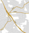
Its starting point is in the centre of Leeds, according to current maps it's at the corner of Woodhouse Lane (A660) and Claypit Lane (A58). Its original start point could be traced to the original line of the A58 by the station. Heading north from here, the road crosses the Leeds Inner Ring Road (A58(M)) in two separate carriageways, with a grassy area in the middle and even a couple of minor roads in between them. They merge just before the Parkinson Building, which shows the frontispiece of Leeds University. Following the campus, the road crosses through Hyde Park and into the student-filled district of Headingley; this area is often very busy, especially at peak times.
The road continues in a general north-west direction through the suburb and onto Lawnswood, where the road crosses the A6120 Leeds Outer Ring Road. It is dualled for the next half-mile heading northwards. Near to the end point of this dual carriageway is the terminus for the proposed Leeds Supertram's northern line.
The road continues through the affluent suburb of Adel. Locally this road is known as Otley Road, although 'Otley Old Road' follows the original route towards Tinshill to the west; the A660 has always had its current route, however. After Adel, the road leaves the urban area of Leeds and heads towards the equally prosperous village of Bramhope, and meets the A658 at the top of Pool Bank, which forms a ridge of hills to the north of Leeds and Bradford. On crossing this road, the A660 winds around a corner, and quite suddenly there are excellent views towards the north of the Lower Wharfe Valley, and across towards Nidderdale in the distance. At this stage the road drops steadily, hugging the hill, with a crawler lane available to vehicles heading upwards.
After two miles, the road meets a roundabout at the start of the Otley bypass.
Section 2: Otley – Burley in Wharfedale
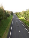
Originally the A660 used to head into Otley (to end on the A659), but it now brushes along the southern fringes of the town, taking the route of the old Pool to Burley railway line. The bypass is single carriageway and meets the A659 and A6038 at the eastern end of the town. The road, still as part of the bypass, ultimately meets the old pre-bypass route at the very end of the Otley urban area, and eventually meets the A65 at Burley-in-Wharfedale. The Otley to Burley section was originally the A659 but became the A660 as that's the way the trunk road went.
The road is interesting because it runs in parallel to the A65, yet it forms the preferred (and signed) route. It is possible that the road used to form part of an old line between Leeds and Greenhowe Hill in North Yorkshire, if one follows the road without turning off the direct line. There is evidence that it was an old route by the mileposts along it, marked in miles and furlongs, to Leeds Bridge, implying the real route start. It may, however, form part of a newer route by the presence of the also-parallel 'Otley Old Road' which heads through Tinshill and over the Chevin near Carlton. It is arguable that the road should be renumbered to A65... but as we know, that causes mass confusion. Original Author(s): Stuart Mitchell
History
Abandoned Proposals
During the 1960s and early 70s there were plans to upgrade the A660 to dual carriageway. Evidence exists to this day of the proposed dualling. A bridge over the A58(M) which is used as a car park was intended to be the northbound carriageway. Blenheim Terrace is a fudge and was never intended to be the northbound carriageway. Continuing north there is a section of Woodhouse Lane which is already dualled. Next we enter Headingley which would have been completely bypassed. Again there is evidence on the ground of where the bypass would have ran. On the corner of Alma Road is a Premier Inn. The multistorey car park park attached to the hotel is curved on its northeast side to allow space for the northbound offslip at the GSJ. The line of the bypass south of here to the Original Oak public house is clearly discernible on modern aerial imagery along with the positioning of the houses on Oakfield. North of Headingley the provision for dual carriageway is less obvious but north of the A6120 the houses on east side of the road are set back with clear space for the additional carriageway.
Otley Bypass
The 1.6 mile road was completed in August 1984 (per the 1985 National Roads England Report). Outturn works cost was £3.6 million.


