Chelmsford
| Chelmsford | |||
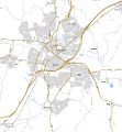
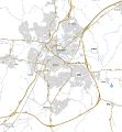
| Location Map ( geo) | |||
_Peter_Stack_-_Geograph_-_2185593.jpg) | |||
| Springfield Road | |||
| |||
| County | |||
| Essex | |||
| Highway Authority | |||
| Essex | |||
| Forward Destination on | |||
| A12 • A130 • A414 | |||
| Next Primary Destinations | |||
| Basildon • Colchester | |||
| Other Nearby Primary Destinations | |||
| Basildon • Harlow | |||
| Places related to the A12 | |||
Colchester • Romford • Ipswich • London • Lowestoft • Docklands • Brentwood • Marks Tey • Stratford, London • Hackney • Ilford • Great Yarmouth | |||
| Places related to the A130 | |||
| Places related to the A414 | |||
Chelmsford is the county town of Essex. The town has a population of roughly 157,000 and is still growing. The main road in the area is the A12, though several other key routes meet in the town.
The town has had several attempts at a bypass, the most of recent of which was a grade separated D2 some considerable distance away from the town, constructed in 1986. It replaced an earlier version from the 1930s. The A130 multiplexes around the town on the bypass, and has been extensively upgraded to form a second high quality route from here to the Dartford Crossing.
The A414 has always been a route to Chelmsford, though its modern course runs on a completely different route to its original classification, and now continues eastwards to Maldon.
The Bypass
The first bypass was opened in 1932. Like many such roads of its time it suffered from having houses built alongside parts of it almost immediately after opening which effectively made it a part of the town the road was designed to avoid. The Restriction of Ribbon Development Act of 1935 came too late to save it but ultimately stopped any further development taking place until the 21st century.
By 1968 much of the A12 was fully dualled between London and Colchester and those sections that weren't had plans in place. The only remaining section of single carriageway without firm plans was the 1932 bypass through Chelmsford. The Margaretting Bypass and Springfield-Boreham Bypass were opened in the early 70s with the intention that a route following the existing bypass would be built. However the ribbon development made a route built to a similar standard as the rest of the A12 problematic. As early as 1971 plans were made for a southern bypass which avoided the need for demolition of houses along the existing route. Had this scheme been built a section of the westbound carriageway of the Springfield-Bypass would have been abandoned soon after opening.

A public consultation took place in 1973 which was the first of its kind in the UK. Three routes were put forward by the department - a route following the existing bypass, a northern bypass and a southern bypass. About two thirds of the responses to this consultation favoured the southern bypass and in 1974 draft orders were published for this scheme. This was improved over the 1971 proposals and is essentially the bypass we know today apart from the junction layouts.

In 1975 the scheme went to public inquiry. Several alternative routes were looked at including those along the 1932 bypass. Three of these were studied in detail. Those following the existing bypass would require the loss of many houses such as scheme B which would take 170 properties. It should be noted that due to the higher traffic volumes in urban areas both inner routes maintain a separate local access road alongside the new bypass to separate internal traffic from through traffic. Of the two schemes it was B that performed better with higher capacity at the Army and Navy Roundabout. Scheme C is a hybrid consisting of part of the southern bypass and the existing Great Baddow Bypass. This route however severs the planned development area near Brookend. The southern bypass wasn't without its problems either as the distance was significantly longer than the existing bypass and it was feared some traffic would continuing using the shorter route at night when traffic levels were lower. Another issue with the southern bypass was the loss of agricultural land. Taking into account the pros and cons of an inner or southern bypass the inspector at the inquiry concluded that an inner bypass should be constructed but in such a manner that it limits the environmental problems and demolition of property associated with scheme B.
Scheme A5

Scheme B
Scheme C


The result of the public inquiry meant the government accepted the proposal for an inner route but further work stopped. In 1979 work resumed but the proposal had shifted back to the southern bypass. The route was altered slightly and the junctions all became dumbbells. The road opened in 1986 nearly 20 years after plans were first mooted.
Routes
| Route | To | Notes |
| London, Brentwood | ||
| Colchester | ||
| Stansted Airport, Sudbury | ||
| Basildon, Southend-on-Sea (A127) | ||
| Harlow (M11) | ||
| Maldon, Sudbury | ||
| Sawbridgeworth | ||
| Gt. Baddow | ||
| Stock, Billericay | ||
| Galleywood, Gt. Baddow | ||
Videos
AEC Dump Trucks and Mercury Lorries - Chelmsford Bypass
AEC Mercury lorries at work on the construction of the A12 Chelmsford by-pass near the juction of the A130 back in 1986.


