Star.pngStar.pngStar.pngStar.pngStar grey.png

A805

From Roader's Digest: The SABRE Wiki
Jump to navigation Jump to search
A805
Location Map ( geo)
The A805 runs past the two stations shown
Cameraicon.png View gallery (1)
Buchanan Street
From:  St. Enoch, Glasgow (NS588650)
To:  Cowcaddens, Glasgow (NS589658)
Distance:  0.6 miles (1 km)
Met (1922) A8, B809, A802, A804, A81
Now part of:  Unclassified and pedestrianised
Traditional Counties

Lanarkshire

Route outline (key)
A805 St Enoch - Cowcaddens
Aerial view of pedestrianised Buchanan St.

Tucked away in central Glasgow, the A805 was a short-lived A road, certainly one of the most changed since its original classification.

1922 route

When first classified in 1922, Buchanan Street was designated A805 throughout. It ran from the A8 Argyle Street, near St. Enoch railway station, northwards terminating a number of side streets. It had crossroads junctions with the B809 St Vincent Place, the A802 West George Street, Bath Street and the A804 Sauchiehall Street near Buchanan Street railway station. After these, it curved gently westwards to end, after just over half a mile, at Cowcaddens Road where it also met West Nile Street, which in 1922 was the route of the A81. Buchanan Street remains one of Glasgow's premier shopping streets, and it would have been just as busy back in the 1920s, which perhaps makes it surprising that it was given a number when it ran parallel for its entire length to the A81 along West Nile Street.

1935 and subsequent reclassification

In the 1935 Road numbering revision, the entire A805 route became part of the A82, which had originally run west of Glasgow along Argyle Street, to form a link to the Great Western Road, built in 1927. The junction with Argyle Street was therefore on an extended A814. Later still, the A82 (ex-A805) was removed from the area completely following radical changes to Buchanan Street in the 1960s and 1970s; its southern half (as far as Sauchiehall Street) was pedestrianised allowing only very limited goods and services access, and its northern half was obliterated completely to be replaced by the Glasgow Royal Concert Hall and a multi storey car park. As a result, no part of the former A805 is now normally navigable for vehicular traffic.

Curiously, however, despite this definitive record that the A805 ceased to exist in 1935, the OS continued to mark it on large scale sheets into the 1960s

The 1922 MOT Road List defines this route as: Glasgow (Buchannan Street)
An official document from 16-5-1934 details the following changes: Wholly renumbered A82


A805
Related Pictures
View gallery (1)
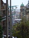
Buchanan Street - Geograph - 1017120.jpg
Other nearby roads
Glasgow
NCN75 • A8 • A8(M) (Baillieston) • A8/Old Greenock Road • A74 • A77 • A80 • A81 • A82 • A89 • A721 • A726 • A727 • A727 (Glasgow - Clarkston) • A728 • A729 • A730 • A731 • A732 • A736 • A737 • A739 • A749 • A754 (Renfrewshire) • A761 • A763 • A802 • A803 • A804 • A804 (Kelvingrove - Townhead) • A806 • A806 (Canniesburn - Scotstoun) • A808 • A809 • A814 • A876 (Glasgow) • A879 • B744 (Muirkirk - Glasgow) • B759 • B760 (Silverbank) • B760 (Tollcross) • B761 (Glasgow) • B762 • B762 (Braidfauld-Shettleston) • B763 • B763 (Dalmarnock - Parkhead) • B765 • B765 (Rutherglen) • B766 • B767 • B768 • B769 • B773 • B805 (Barlanark) • B807 • B808 • B808 (Millerston - St Rollox) • B809 • B810 (Great Western Road) • B811 • B812 (Glasgow - Bardowie) • B813 • B860 (Glasgow) • B7053 • B7058 • B8030 • B8049 • B8050 • E05 • E16 • E31 (via Carlisle) • E31 (via Newcastle) • E33 (London - Glasgow) • E100 • E111 (Old System) • East Kilbride Motorway • Edinburgh - Glasgow New Road • EuroVelo 1 • Glasgow Inner Ring Road • Hamilton - Cumbernauld Motorway • M6 • M8 • M73 • M74 • M77 • M80 • M81 • M82 • M83 • Military Way • NCN7 • NCN754 • Paisley - Hamilton Motorway • T12 (Britain) • T27 (Britain) • T28 (Britain) • T91 (Britain)
A800-A899
A800 • A801 • A802 • A803 • A804 • A805 • A806 • A807 • A808 • A809 • A810 • A811 • A812 • A813 • A814 • A815 • A816 • A817 • A818 • A819

A820 • A821 • A822 • A823 • A824 • A825 • A826 • A827 • A828 • A829 • A830 • A831 • A832 • A833 • A834 • A835 • A836 • A837 • A838 • A839
A840 • A841 • A842 • A843 • A844 • A845 • A846 • A847 • A848 • A849 • A850 • A851 • A852 • A853 • A854 • A855 • A856 • A857 • A858 • A859
A860 • A861 • A862 • A863 • A864 • A865 • A866 • A867 • A868 • A869 • A870 • A871 • A872 • A873 • A874 • A875 • A876 • A877 • A878 • A879
A880 • A881 • A882 • A883 • A884 • A885 • A886 • A887 • A888 • A889 • A890 • A891 • A892 • A893 • A894 • A895 • A896 • A897 • A898 • A899

Defunct Itineraries and Motorways: A804 • A806 • A817 • A818 • A823(M) • A825 • A833 • A859 • A862 • A872 • A876 • A882 • A896


SABRE - The Society for All British and Irish Road Enthusiasts
Discuss - Digest - Discover - Help